Don O’Meara, President of the Society of Antiquaries of Newcastle upon Tyne John Nolan, archaeologist Richard Pears, buildings historian, project leads for the publication of the decades of excavations that took place around the major urban fortress of Newcastle.
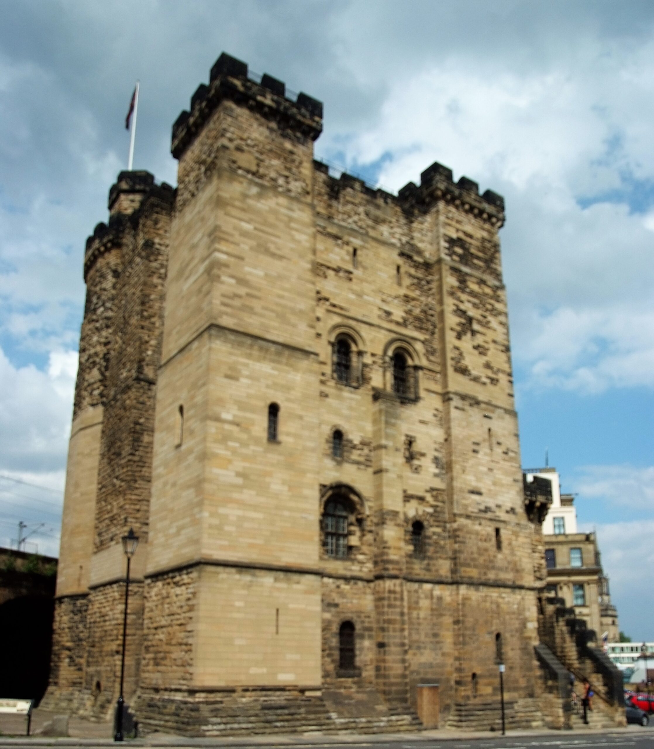
Many towns and cities in England derive their name from fortified positions. However, perhaps none so prominently as when the pre-Conquest settlement of Monkchester was fortified with a royal castle, and became thereafter Novum Castrum super Tynam. Newcastle is fortunate in the survival of its 12th century stone keep against the forces of siege, neglect and demolition, which denuded so many other castles and fortifications across the country, including that which befell our homonymous distant relative under-Lyme.
The keep at Newcastle also has a special place in the history of the Society of Antiquaries of Newcastle upon Tyne, the oldest such provincial society. For over 200 years the image of the keep has appeared on the book plate of our journal (Archaeologia Aeliana), reminding members of our role in preserving it from destruction at the hands of 19th century development (particularly railway construction), as well as our role renovating and managing the building until 2013.
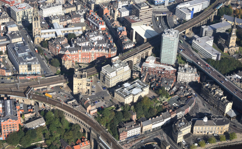
The royal castle from which Newcastle derives its name was founded by Robert Curthose, son of William the Conqueror, in 1080 as a statement of Norman control in a region coveted by the kings of Scotland and with a history of independent-minded local rulers. In the late 1160s and early 1170’s the earth and timber castle was refortified in stone, which included the keep which stands today and which, in the eyes of many Novocastrians, is ‘The Castle’.
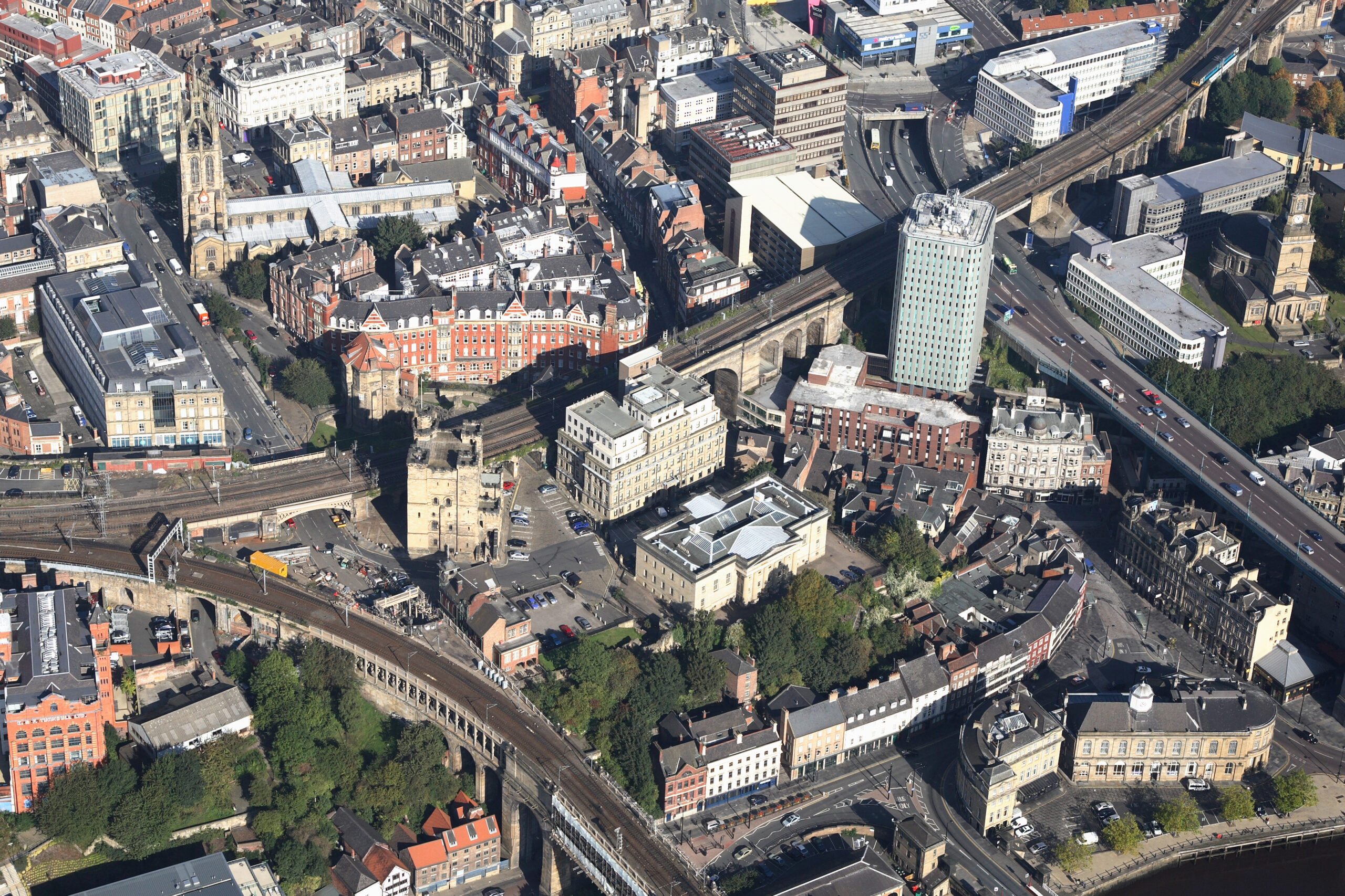
Newcastle Castle from the air, copyright Newcastle City Council
The site is the most archaeologically investigated ‘urban’ castle in North East England, albeit excavations, begun in 1960 and for many years led by Barbara Harbottle, have principally focused on the defensive circuit. Excavations showed how an apparently linear development model can be an oversimplification, highlighted gaps in the understanding of the castle as a whole and revealed problems of correlating archaeological evidence with medieval documentary records. The excavations were also significant in charting the evolution of archaeological practice from essentially amateur archaeological techniques in the 1960s to more modern, scientific investigation. Analysis of the finds offers to reveal new insights into the material culture of the castle’s occupants. Despite the importance of investigations at this site, there has been no published report on the medieval excavations since 1981. This project aims to complete this.
Between 1981 and 1992 further excavations on the castle site revealed more evidence for the evolution of the castle and aspects of its associated infrastructure. It has been a long running ambition of this Society to see these works brought to publication and to wider academic attention. In 2024 the principal excavator of the site in the 1990s John Nolan, buildings archaeologist and historian Richard Pears, and I in my capacity as editor of Archaeologia Aeliana sought to rectify this situation.
This project involves a synthesis of 30 years of excavations and a reassessment of their results, a new building analysis and interpretation of the site, and the compilation and editing of these results into a single text. With gratefully received funds from Newcastle City Council, the Castle Studies Trust, and the Castle Studies Group we are now progressing with the preparation of a special edition of Archaeologia Aeliana which will achieve the aim of disseminating these important results.
Though there are still funds required that would allow for a full open-access publication, we aim to publish this special edition monograph in early 2027.
In his latest book, Crusader Storm, Dr Nic Morton takes a new look at the Crusades, as not as a single clash of faiths, but as a dynamic era of war, commerce, innovation and exchange. In this piece he looks at why the crusaders struggled to expand their territory after their initial success.
Viewed from a purely military perspective, the First Crusade was a wildly over-ambitious undertaking. When Pope Urban II launched the campaign in 1095, he set participants the challenge of marching for hundreds of miles through friendly, then hostile territory, during which they would need to confront and defeat a whole series of enemy armies before taking and holding the city of Jerusalem.
The chances of surviving the venture were extremely low and the early waves of crusaders all met with defeat very quickly, but the final wave achieved its objective and – as is well known – brutally conquered Jerusalem in 1099. In later years, the crusaders (or “Franks” as they came to be known) expanded their territories, working outwards from the cities they acquired or conquered during the crusade: Edessa, Antioch and Jerusalem. Bolstered by tens of thousands of pilgrims, mercenaries and settlers from Western Christendom, these territories, known collectively as the Crusader States, continued to expand for two decades, pushing their frontiers outwards seizing many towns and castles.
So what stopped them? Why didn’t they continue to expand until the entire region lay under their dominion? This blog post will explore this question by focusing on one very serious obstacle to their continued expansion – the major cities of Damascus, Aleppo and Cairo.
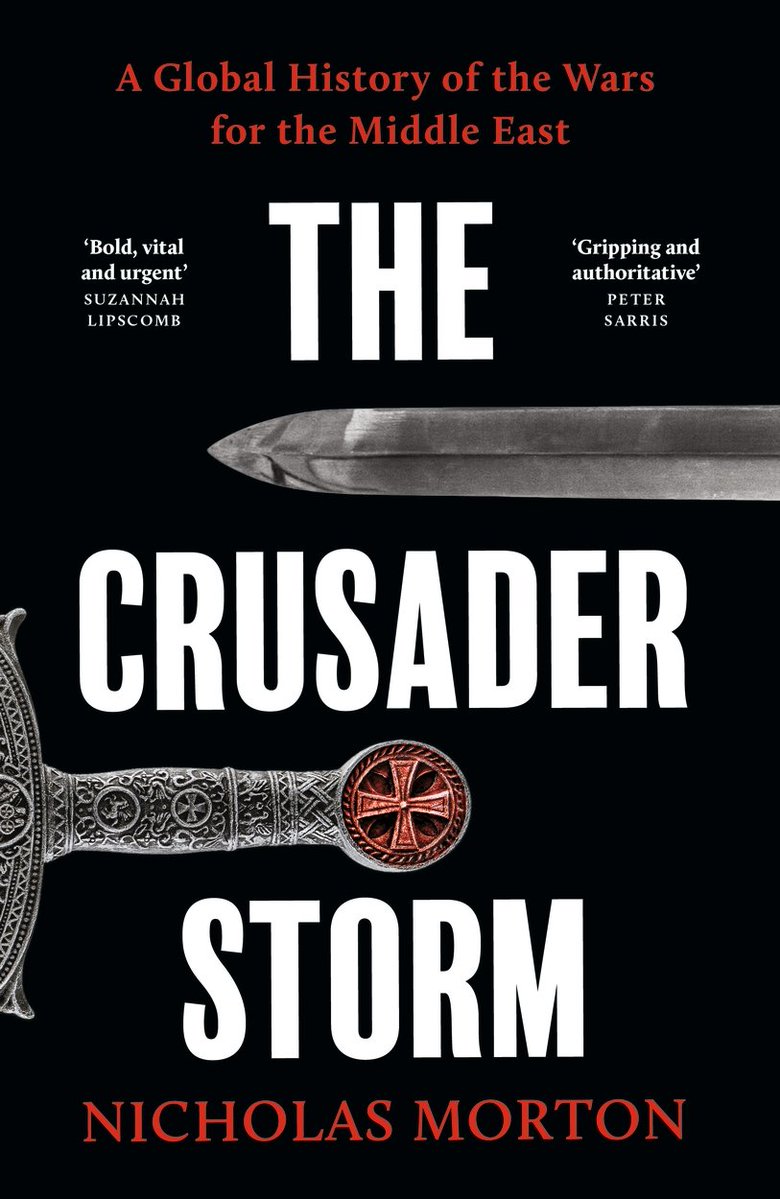
The Lebanese coast, copyright Dr Nic Morton
Spool forward to the early 1120s and the Crusader States had grown considerably. In the south, the kingdom of Jerusalem (the largest Crusader State) controlled much of the Levantine coastline from Beirut in the north, down to Jaffa in the south, extending inland beyond the Jordan river. In the north, the principality of Antioch, county of Tripoli, and county of Edessa were also major powers, despite a serious defeat suffered by Antioch in 1119. Most of the coastline, complete with its major commercial ports, lay under their control and increasingly they turned their attention inland.
This is where they faced the biggest obstacles to their continued expansion. Frankish armies couldn’t seize Syria in its entirety without tackling the fortress cities of Damascus or Aleppo, and they couldn’t expand into Egypt without conquering Cairo. Over the next five decades the Franks made serious attempts to seize each of these cities: Aleppo in 1124-5, Damascus in 1129 and 1148, and Cairo in 1168, but they failed each time. What I’m describing here is their high-water mark, the culmination point – the line beyond which they proved unable to expand.
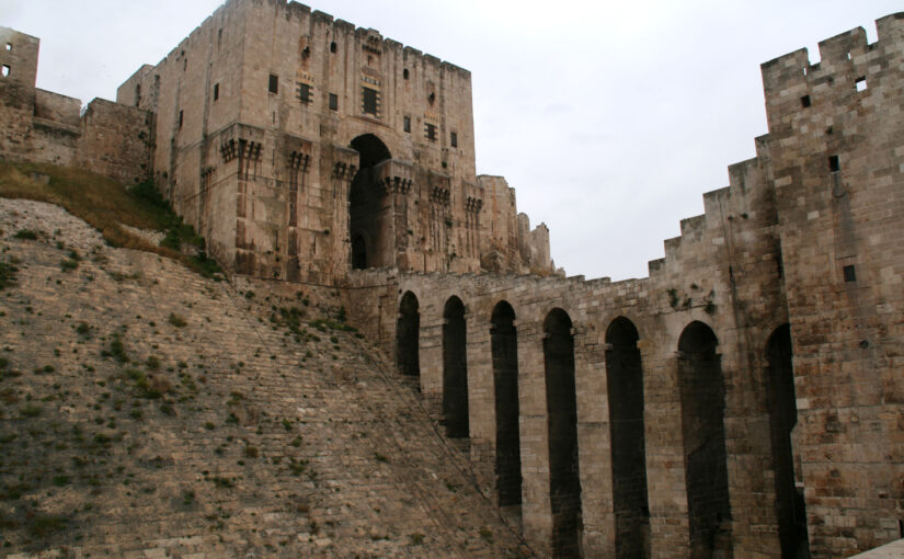
So why were they so consistently unsuccessful? Why couldn’t they capture these cities? When historians discuss the conquest of major castles or cities, they typically talk about these strongholds’ fortifications and the siege weapons used to tackle them. But with big cities, there is another point to consider – the urban populations themselves. These were all very large cities, home to tens of thousands of people – in Cairo’s case possibly hundreds of thousands – far bigger than anything they had tackled so far. There was every danger that a besieging army would fight its way across the ramparts only to be cut to pieces by the population as the attacking Franks became split up within a maze of narrow streets and alleyways. This was a serious concern. Notably when the Turkish ruler Zangi besieged Damascus in 1139, insiders offered to open one of the gates for him, but he still refused to order the attack; seemingly he knew very well that the population would resist his attempts to take control and they – not the fortifications – were the major obstacle.
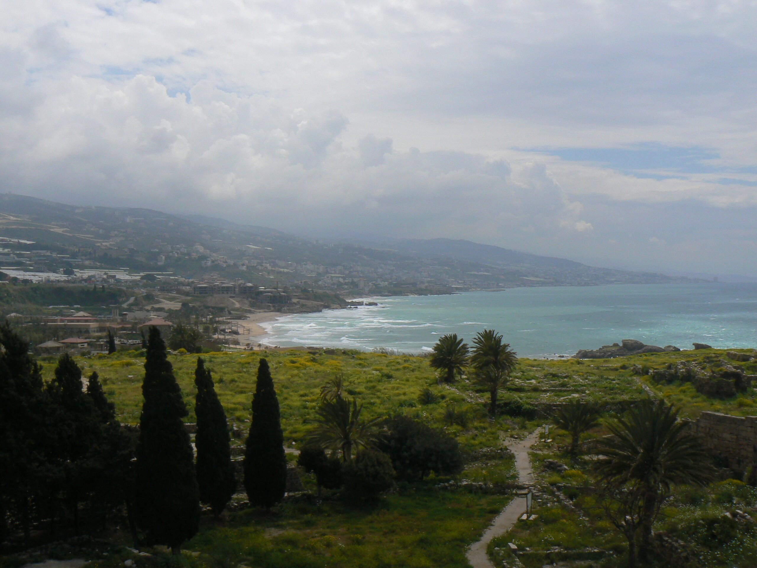
Citadel of Aleppo, rebuilt in the early thirteenth century, copyright Dr Nic Morton
In this way, the conquest of these cities – and therefore the continued expansion of the Crusader States – hinged on the Franks’ ability to persuade urban populations either to endorse, or at least to tolerate, the idea of Frankish rule. For cities of this size, simple military overthrow wasn’t sufficient to guarantee their control in the long run. Some Frankish commanders recognised this reality and, when King Baldwin II of Jerusalem besieged Aleppo in 1124-5 he worked with an Arab ruler named Dubays who he planned to install as a client ruler in the event of the city’s fall. Unfortunately for them, Aleppo’s population didn’t favour the idea of Dubays as their new client ruler and they resisted their besiegers vigorously (and successfully). Likewise, in 1129 Baldwin II tried to conquer Damascus with assistance from the city’s Nizari community (commonly known today as the “Assassins”), but the city’s governor massacred the Nizaris before the Frankish army could arrive. The Franks were less effective at winning the population’s support in their later endeavours but in every case, the broad consensus among the general population remained a vital consideration.
In this way, a decisive factor for the Crusader States in the continued efforts to expand – and a central reason for their failure in these endeavours – were their unsuccessful efforts to gain control over these major cities. Their failure, by extension, enabled resistance to gather in these cities and, in later decades, these regional capitals acted as marshalling points for the Crusader States’ overthrow.
Alice Connelly of the National Trust for Scotland takes a look at The Re-imagining of Fyvie Castle project.
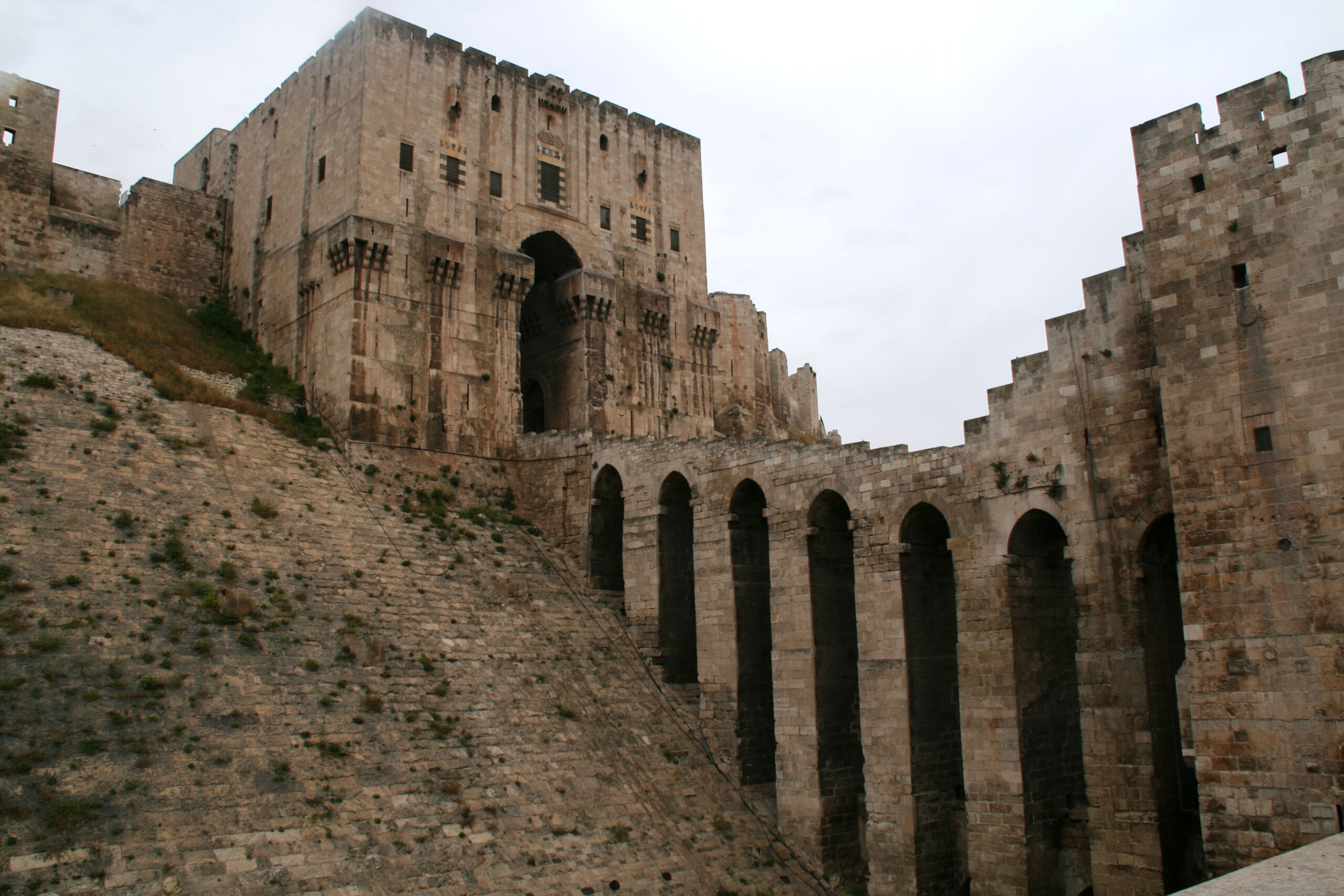
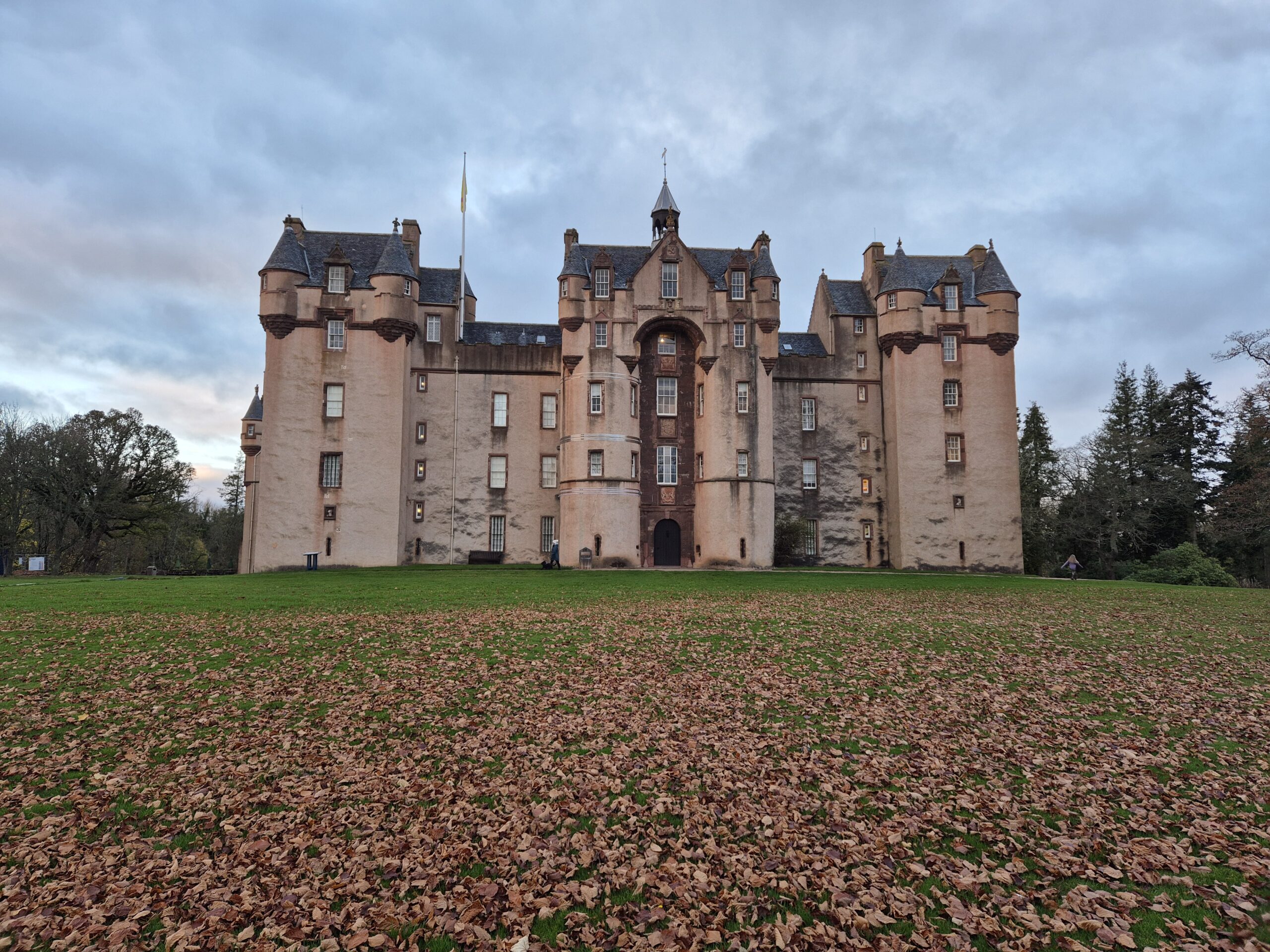
Rising above the rolling landscape of Aberdeenshire, Fyvie Castle is the quintessential Scottish fairytale castle. Its pink harled walls, ornate towers and landscaped grounds draw thousands of visitors from the nearby A96 each year, inviting them to explore centuries of Scottish history hidden behind its striking exterior.
Inside, visitors are guided through the castle’s richly furnished rooms by a dedicated team of volunteers, hearing stories of royal visits, political intrigue, battles, folklore and ghostly legends. Yet the magnificent castle we know today emerged from much humbler beginnings.
Fyvie Castle today, copyright National Trust for Scotland
Fyvie began as a timber stronghold built on a natural defensive platform, protected by the River Ythan and surrounding bogland. Over time, the site evolved dramatically: timber was replaced with stone and successive generations expanded and remodelled the building. What began as a laird’s fortified residence gradually transformed into a royal stronghold and, eventually, the lavish country estate seen today.
Fyvie also occupies an important place within the cultural traditions of north-east Scotland. The castle and village are woven into Scots song and folklore through tunes such as The Bonnie Lass o’ Fyvie and Mill o’ Tifty’s Annie. The latter tells the tragic story of Bonnie Annie and Andrew Lammie, the trumpeter to Lord Fyvie. The grave of Annie Smith, the woman thought to be Bonnie Annie, can still be visited in Fyvie cemetery today, while a carved stone trumpeter stands among the twenty-four decorative figures that crown the castle roofline, a reminder of how deeply history, music and storytelling are embedded within the site.
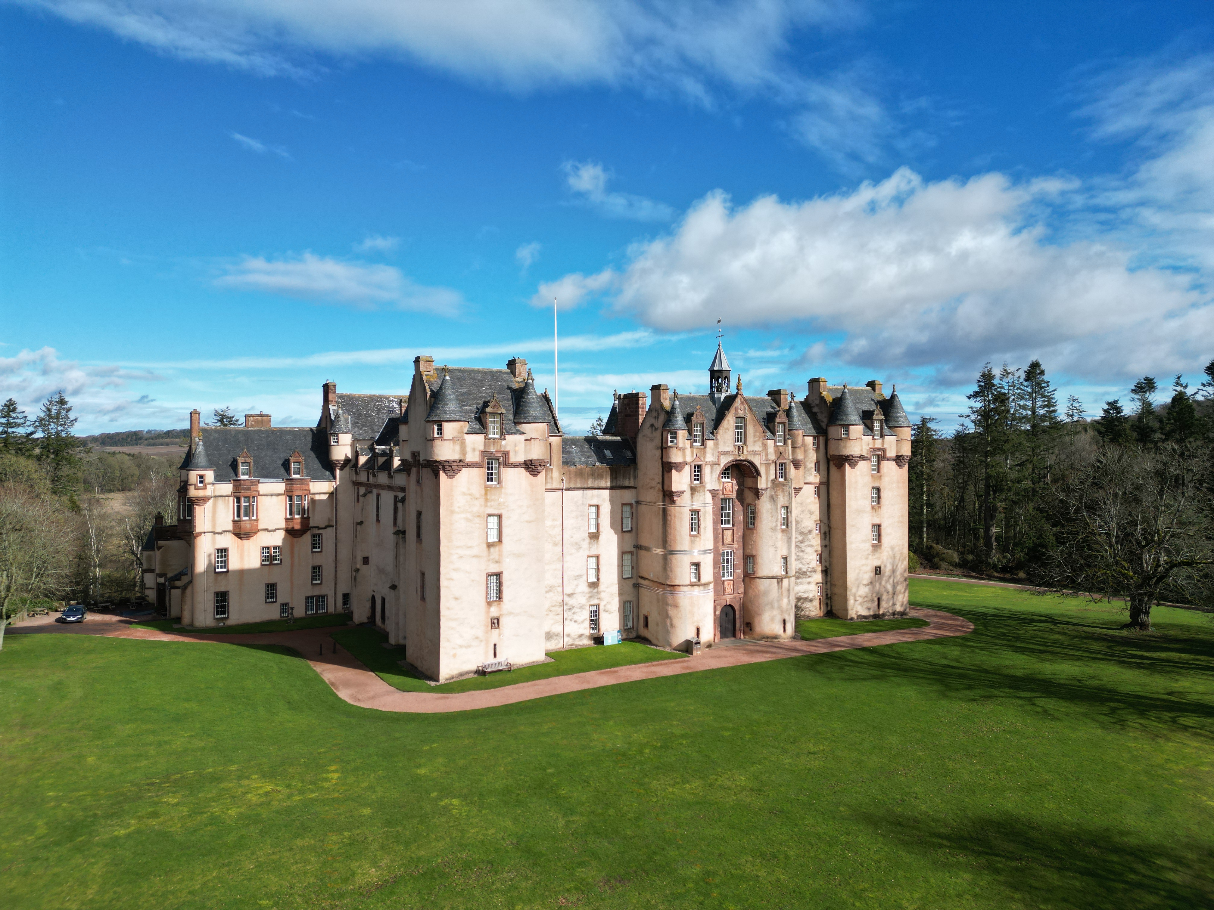
Fyvie Castle today, copyright National Trust for Scotland
Recently, Fyvie featured in the National Lottery Heritage Fund supported television programme Great British Castle Rescue, presented by Rick Edwards. The programme explored both the architectural significance of the castle and the challenges involved in conserving such a complex historic building for future generations.
At the heart of this work is the Fyvie Reimagined project. The project aims not only to conserve and repair the fabric of the castle, but also to deepen public understanding of how Fyvie developed over time. Fyvie remains a focal point for the local community and an Aberdeenshire landmark; cherished by regular visitors who walk the grounds throughout the seasons, as well as those travelling from much further afield to experience one of Scotland’s great historic houses.
As part of this wider effort, the Castles Studies Trust has funded a new series of interpretation drawings designed to help visitors visualise key moments in the castle’s development. While the standing building tells a remarkable story, understanding how Fyvie changed across seven centuries can be difficult when viewing the castle only in its present form. The illustrations aim to bridge that gap, allowing visitors to imagine Fyvie at different stages in its history and better understand how architecture, landscape and daily life evolved together over time.
Initial image of Fyvie as an enclosure castle in 1398 by Jan Dunbar, copyright Jan Dunbar
Several key periods in the castle’s development were selected for reconstruction, charting Fyvie’s transformation.
The early palisaded, motte and bailey type structure, 1211
Enclosure castle in stone, 1398
Full courtyard palace, 1596
North and East wings, with formal gardens in ruins and general dilapidation of main blocks, 1734
South and West Ranges restored, altered roofline with new tower and formal parkland setting, 1784
Castle as we know it today, with Leith Tower as fresh addition, connection of Butlers apartment by new kitchens, 1980
Each drawing will capture not simply the appearance of the castle, but also something of the activity and atmosphere surrounding it.
Importance was also placed on depicting construction work and scaffolding within one of the earlier scenes. Too often, castles are presented as finished monuments rather than places shaped by generations of labour, craftsmanship and continual rebuilding. Showing the physical process of construction helps highlight the immense skill and effort required to create buildings like Fyvie, while also drawing attention to the ongoing conservation work needed to preserve them today.
The illustrations therefore serve several purposes at once. They help visitors engage more deeply with the castle’s long history, provide an accessible way of communicating archaeological and architectural research, and reinforce the importance of protecting Scotland’s built heritage for future generations. By visualising change over time, the drawings encourage people to see Fyvie not as a static monument, but as a living site that has continually evolved across centuries of Scottish history.
Dr Andy Moir of Gloucestershire Historic Buildings Group takes a look at the results from their attempts to date the outer ward of Sudeley Castle
Tree-ring dating at Sudeley Castle has established that the outer courtyard roofs were constructed over three years between 1569 and 1572. This result overturns the previous history which indicated that the castle roofs were destroyed during the Civil war and identifies that the roofs were likely built by Edmund Brydges (the 2nd Lord Chandos).
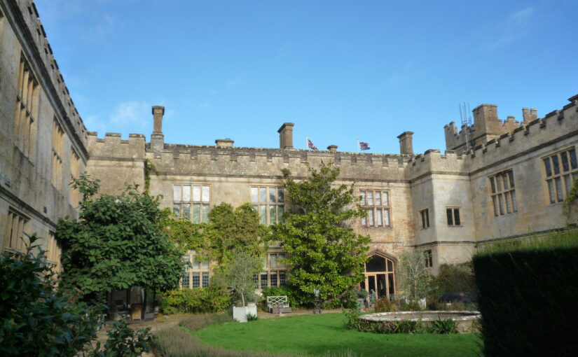
Sudeley Castle Outer Courtyard looking north, copyright Dr Andy Moir
Sudeley Castle has Saxon origins, but its history really developed from 1441 with Ralph Boteler (Baron Sudeley and Lord Chamberlain of the King’s Household) who set about developing a castle to reflect his new-found status. In later Tudor times, Thomas Seymour was granted the castle by Henry VIII and after marrying the king’s widow, Katherine Parr he set about refurbishment of the Sudeley Estate. Katherine became pregnant at a relatively late age and unfortunately died a few days after childbirth. Following her death and Seymour’s arrest for treason following his desperate attempt to grab power at the expense of his brother Edward Seymour, the castle was then gifted to John Brydges, the Constable of the Tower of London. This gift by Queen Mary I was followed with the title of Lord Chandos being granted to the family. John’s successor, Edmund Brydges seems to have been further developing the castle, enhancing the work of Boteler and Seymour and the family contributed to Winchcombe with the building of Almshouses by Edmund’s wife Dorothy. The Brydges family maintained the castle throughout the rest of the Tudor times and supported the Royalist cause following the start of the Civil War.
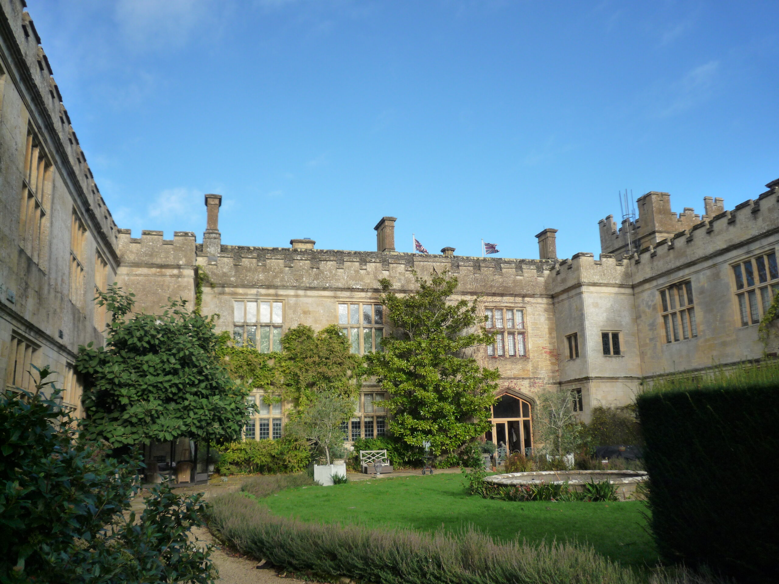
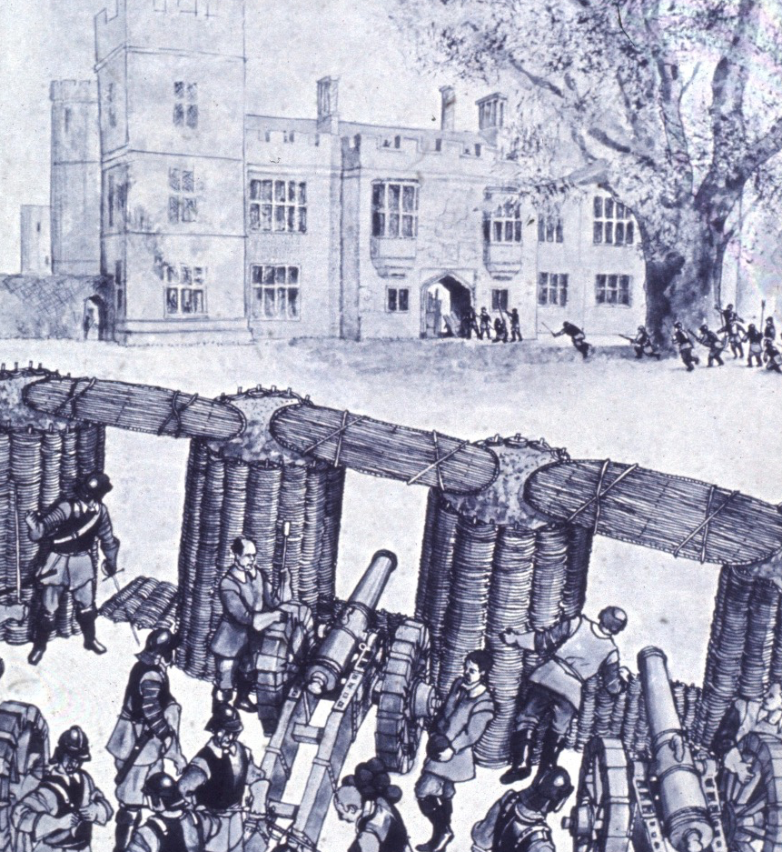
Besieging Sudeley Castle in 1643, during the Civil War
Sudeley had been used as the base by both Prince Rupert and Charles I from where they had launched attacks on Cirencester and preparations had been made to attack Gloucester. Following these failed attempts, Parliamentary troops had successfully besieged the castle on two occasions, bombarding the castle with cannon and after the second siege, the order was given for a systematic slighting (made un-inhabitable). Roofs were taken off and many walls were razed to the ground. Details of the destruction became clear when Lady Jane Brydges widow of George Chandos tried to sue for recompense. This was shown by depositions in the archives taken from five craftsmen stating that the castle had been fully destroyed and this had been signed off by two judges from Gloucester, Edward Slaughter and Robert Megge, but as the dendrochronology report went onto show, the slighting was not as comprehensive as claimed and roofs to the East, West and part of the North range of the outer courtyard were still intact.
It had previously been thought that the castle had been left in ruins for the next 180 years, and few of the original structures at Sudeley Castle were thought to have survived before extensive restoration in the 19th century funded by the Dent brothers and their heir John Coucher Dent and his wife Emma.
In 2025 castle archivist Derek Maddock invited the Gloucestershire Building Recording Group (GBRG) to survey the outer courtyard roofs. Unexpectedly, the survey identified that east, west and north range roofs of the outer courtyard contained mainly oak timbers that were likely to be Elizabethan. As this finding completely changed understanding of the castle’s history, a project to precisely tree-ring date the roofs was conceived. This project was supported by the Castle’s owner, Lady Ashcombe, and funded by the Castle Studies Trust (www.castlestudistrust.org).
Dr Andy Moir of GHBG taking one of the 30 core samples from the roof.
The 2026 project saw 30 pencil-like core samples drilled from the castle roofs. Tree-ring series from twenty of these timbers matched together to form a 159-year mean chronology that was dated to span 1413 to 1571. The oldest tree used in construction of the roof started growing in 1413 and the trees were all felled between the spring of 1569 and the winter of 1571/2. As it was common medieval practice to convert the tree into timbers before they seasoned, construction of the east, north and west range roofs of the outer courtyard likely occurred between 1569 and 1572. To give some idea of the scale of the construction, the west, north and east range roofs are around 36m, 38m and 46m in length, respectively. Yet still the carpenters of the day likely managed to complete this huge construction over just three years. This result therefore overturns the previous history which indicated that the castle roofs were destroyed during the Civil war and identifies that the roofs were likely built by Edmund Brydges (the 2nd Lord Chandos). A fantastic development in the history of Sudeley Castle.
Dr Sarah Kerr, Lecturer in Archaeology at University College Cork and expert grants assessor for the Trust, takes a look at her new focus of study, Tower Houses in Ireland, and the issues involved in researching them.
Tower houses have received considerable attention in recent years, most notably Victoria L McAlister’s monograph on the subject (McAlister 2019). Her work brought to the fore the multiplicity of functions performed by tower houses particularly their crucial role in exploiting the natural environment and contributing to national and international economies. Breen and Raven focused on Gaelic-maintained areas on the long western coast of Ireland and considered late medieval tower houses as the primary expression of secular lordship (Breen et al. 2017, 151). Both important pieces of work drew upon – and contributed to – the landscape turn in castle studies by exploring the wider, often maritime, environment.
Despite these recent developments there are arguably a number of issues which inhibit our understanding of tower houses and may even restrict future avenues of research. Summarised as the tower house problem, these issues are highlighted in the hope that greater awareness may assist averting the limitations they impose. There was a vast – albeit unknown – number of tower houses in use contemporaneously in late medieval Ireland. Harold Leask, (d. 1964) the first Inspector of National Monuments in Ireland, calculated that some three thousand tower houses were documented in the Ordnance Survey maps. Therefore he provided the minimum number of how many existed prior to the mid-nineteenth century (Leask 1941; McAlister 2019, 12; Sherlock 2011, 115). Estimations have varied to over 7000 while the Archaeological Survey of Ireland list approximately 1300 known examples (Sherlock 2011, 115; Barry 1993; Barry 2008b, 129). The result is descriptions of Ireland as ‘the most castellated country in Europe’ (Barry 2008) or ‘one of the most castellated parts’ of the Irish and British Isles (Cairns 1987, 31; O’Conor 1998, 25). Certain areas represent this clearly, particularly in Munster and Leinster, with clusters of tower houses in close proximity to one another.
This vast archaeological record has posed a problem for archaeologists and much work of the 1990s and early 2000s focused on creating types and sub-types to dissect the record into manageable portions. Creation of types based on architectural similarities is useful for understanding individual examples and provincial trends but it doesn’t address the phenomenon of the tower house, the vast numbers and clustering in certain areas. As a method it is therefore limited in its usefulness. In addition, it can led to creating boxes and trying to make examples fit therein, which has obvious shortcomings and may result in overlooking the uniqueness of each example.
There is a problem more fundamental to tower house research that needs addressed: should they be considered castles? Tower houses are often referred to as castles, small castles or a type of castle and this seems rational as some examples were described as castellum, cúirt or fortalicium by their contemporaries (McAlister 2019, 15). Their architecture supports this classification, as they display features found frequently at larger castles, such as those built by the Anglo-Normans in Ireland around two centuries before tower house building commenced. These accepted castle attributes include machicolations, battlements, arrow loop windows, narrow entrances and thick walls. Other common castle features identified less commonly at tower houses include yetts (iron gate), hagioscopes (squint at the door allowing a line of sight outside), bawns (enclosure wall), adjoined towers, and some ornamentation such as hood mouldings.
Figure 1: Leamcon (Blackcastle) Castle, copyright Dr Sarah Kerr
This is where the comparison ends, however, as the form of tower houses was distinct from Anglo-Norman castles. Tower houses were comparatively narrow towers comprising as least three storeys, such as Leamcon locally known as Blackcastle (Figure 1) in West Cork. A batter was required to aid stability (thicker walls at the base) which created slightly larger rooms at the upper levels than those on the lower levels. Windows increased in size with height, with small and sparse windows lower on the façade to create a solid and strong base. Vaults were invariably included within to further aid their structural integrity. These were often at ground-floor level but vaults on other floors were also commonplace. At the upper levels there was a wall-walk, pitched wooden roof and crenelated parapet. The latter could take the form of stepped merlons, often attributed to the Gaelic founders, or the square-crenels type, built primarily by English and Scottish settlers. In addition to the clear architectural differences between earlier stone-built castles of the Anglo-Norman period and tower house, their functions were different. Anglo-Norman castles were tools in colonialism (for example, Trim in Figure 2) and displays of the same whereas tower houses were built by Anglo-Irish and Gaelic elites, merchants and rural landowners, lay and ecclesiastical lords during a period of relative peace and economic prosperity. Some comparison between the types have focused on the towers (donjons or keeps) that were the focal point of Anglo-Norman castles however conclusions are limited due to the scarcity of work carried out on tower house settlements; that is, in their immediate surrounds.
Figure 2: Trim Castle, copyright Dr Sarah Kerr
I have recently made the argument that, combined, the above issues create the tower house problem and awareness of this is required to continue studying these buildings in an effective way. The tower house problem is typified in West Cork, a culturally distinct area west of Cork City that encompasses the south-west coastline of Ireland and comprises large peninsulas with numerous small inlets and embayments. The area is dense with extant and lost late medieval tower houses; Figure 3, is a photograph taken from Rincolisky (Whitehall) tower house with Kilcoe tower house visible across the bay. Recent fieldwork sought to examine the density of tower houses, examples of which are sometimes referred to as the ‘West Cork type’, and consider the phenomenon through the lens of spatial analysis, placename evidence and architectural analysis – results forthcoming. The fieldwork however has presented broader questions about whether we should consider tower houses castles. Either way, to do so or not should be justified perhaps with reflection upon terminological limitations. Accepting the distinctiveness of tower houses might be more productive in further understanding the reasons behind their construction and use – and crucially overcoming the tower house problem.
Figure 3: Whitehall and Kilcoe Tower Houses, copyright Dr Sarah Kerr
Barry, T. 1993. The archaeology of the tower house in later medieval Ireland. In H. Andersson & J. Weinberg (eds) The Study of Medieval Archaeology, 211–18. Stockholm: Almqvist & Wiksell International
Barry, T. 2008a. The study of medieval Irish castle: a bibliographic survey. Proceedings of the Royal Irish Academy: Archaeology, Culture, History, Literature 108 (C): p.115-136.
Barry, T. 2008b. The study of medieval Irish castles: a bibliographic survey. Proceedings of the Royal Irish Academy. Section C: Archaeology, Celtic Studies, History, Linguistics, Literature 108C: p.115–136.
Breen, C., & Raven, J. 2017. Maritime Lordship in Late-Medieval Gaelic Ireland. Medieval Archaeology 61(1): p.149–182.
Cairns, C.T. 1987. Irish tower houses: A Co. Tipperary case study. Dublin: Trinity College Dublin.
McAlister, V. 2019. The Irish tower house: Society, economy and environment, c. 1300-1650 1st edition. Manchester (GB): P648 – MANCHESTER UNIV PR.
O’Conor, K.D. 1998. The Archaeology of Medieval Rural Settlement in Ireland. Dublin: Royal Irish Academy.
Sherlock, R. 2011. The evolution of the Irish tower-house as a domestic space. Proceedings of the Royal Irish Academy. Section C: Archaeology, Celtic Studies, History, Linguistics, Literature 111C: p.115–140.
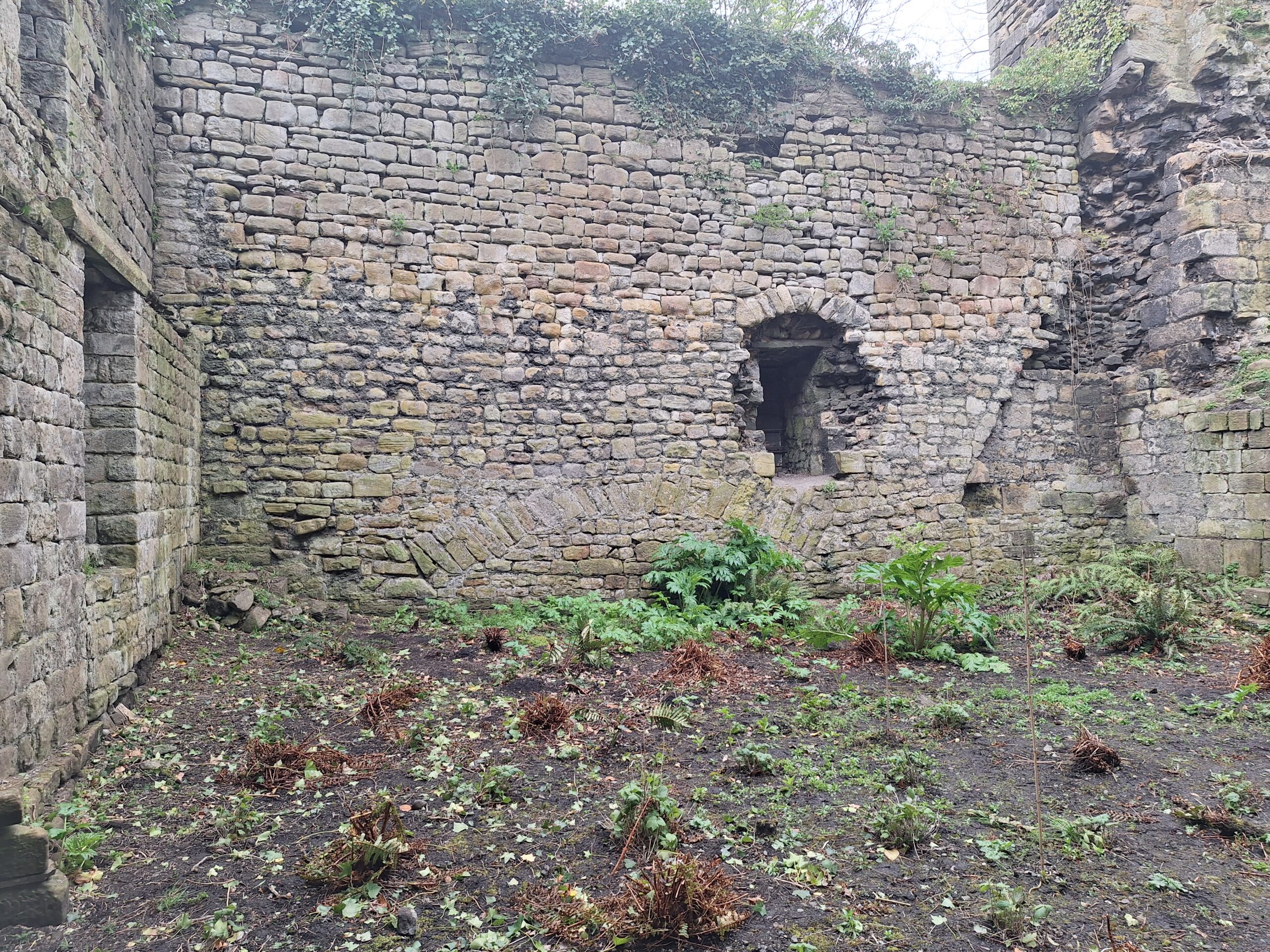
Project Lead Tom Addyman gives an update on how the survey of Cockermouth Castle’s inner ward is progressing following the team’s second visit in April
The survey team returned to Cockermouth in mid-April to carry out the follow-on stage of the analytical survey of the inner ward. The processed base photogrammetric data from the first survey visit was marked up with analytical data such as construction breaks and other interpretative information. The opportunity was taken to extend survey coverage to other areas such as the mural chambers within the gatehouse and to re-survey parts of the exterior that had been better revealed following continuing trimming of obscuring ivy.
A general review was made of the complexities of the fabric, paying particular attention to structural discontinuities and changes in masonry coursing, character, stone type and alignment. The site assessment particularly benefited from the expert insights of Dr Edward Impey and Prof Richard Oram. Significant progress was made on understanding the evolutionary history of the inner ward buildings:
Interior of the south curtain wall showing relieving arch – possibly bridging unstable ground relating to a pre-existing defensive ditch Copyright Tom Addyman
Evidence supporting the idea that the gatehouse range occupied the site of a pre-existing ditch in the form of a broad structural relieving arch within the south curtain
Confirmation that the eastern gatehouse range incorporated the part-built remains of a predecessor of likely mid-late 14th century date that featured evidence for an intended 3-chamber rib-vaulted lower storey. Construction resumed to a somewhat modified design within a decade or two.
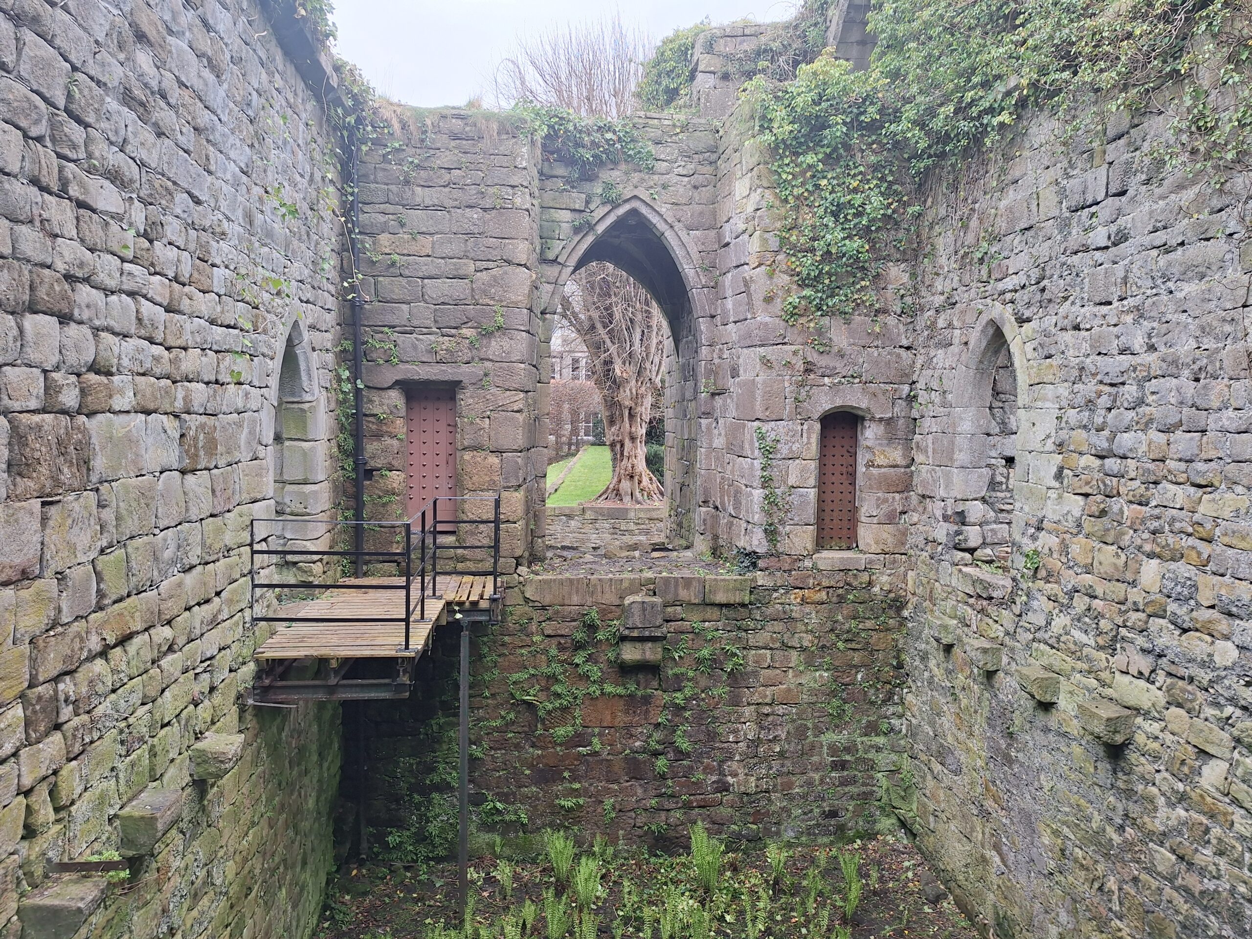
Interior of the gatehouse looking east to the pend copyright Tom Addyman
The architectural peculiarities of the gatehouse itself were better understood, including the possibility of a draw-bridge pit within the pend, details of the pend’s octopartite vault that was found to feature decorative collars and bosses at its main junctions, and the relationship of the large vestibule chamber within to the lodging ranges to either side to which direct access was provided.
The narrow Bell Tower, located at the south-east angle of the inner ward, was concluded to be of early date, possibly of the early 13th century
The south curtain was found to incorporate many finely-worked, diagonally-tooled blocks of a predecessor building, with a number of examples displaying a narrow sunken roll of keeled profile, perhaps c.1200. These provide the earliest date for the construction of the curtain – perhaps in the early-mid 13th century.
The south curtain also provided evidence for a former range of two stories with lean-to roof built against it – joist sockets and corbels, an inserted fireplace at first floor level, and indications of cross–walls. The structure had likely been narrow and at the upper level may have provided gallery-like access between the private apartments of the hall range and the lodging block.
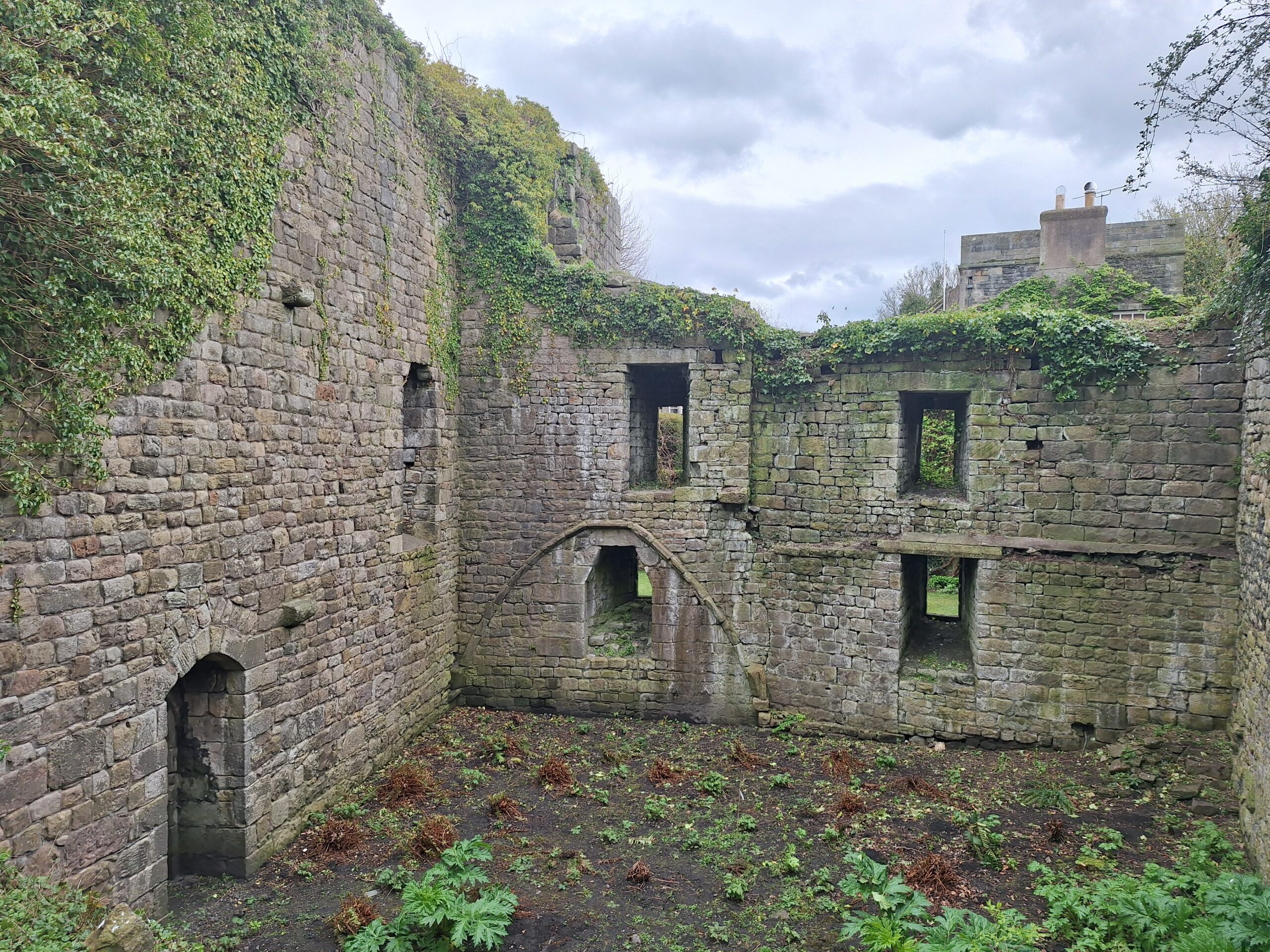
Interior of the lodging block to the south side of the gatehouse, looking east – showing the outline of the intended vaulted cellar. Copyright Tom Addyman
The work was coordinated with the Cockermouth Castle volunteer archive group, overseen by Alison McCann, Consultant Archivist to the Leconfield Estates. Review of archival materials relating to the castle identified a number of significant items such as estate drawings for the various castle buildings, inventories relating to the later 17th century occupation of the site, and a number of early views including some depicting the excavation of the infilled cellarage of the inner ward in the mid-19th century. Tom Addyman presented the ongoing work of the CST-funded survey to the archive group who were very positive in their response.
In May, the upgraded photogrammetric record is being digitised to form a line drawing set that will then be enhanced with analytical and phasing data.
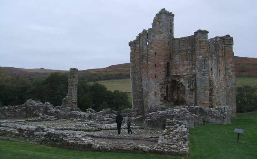
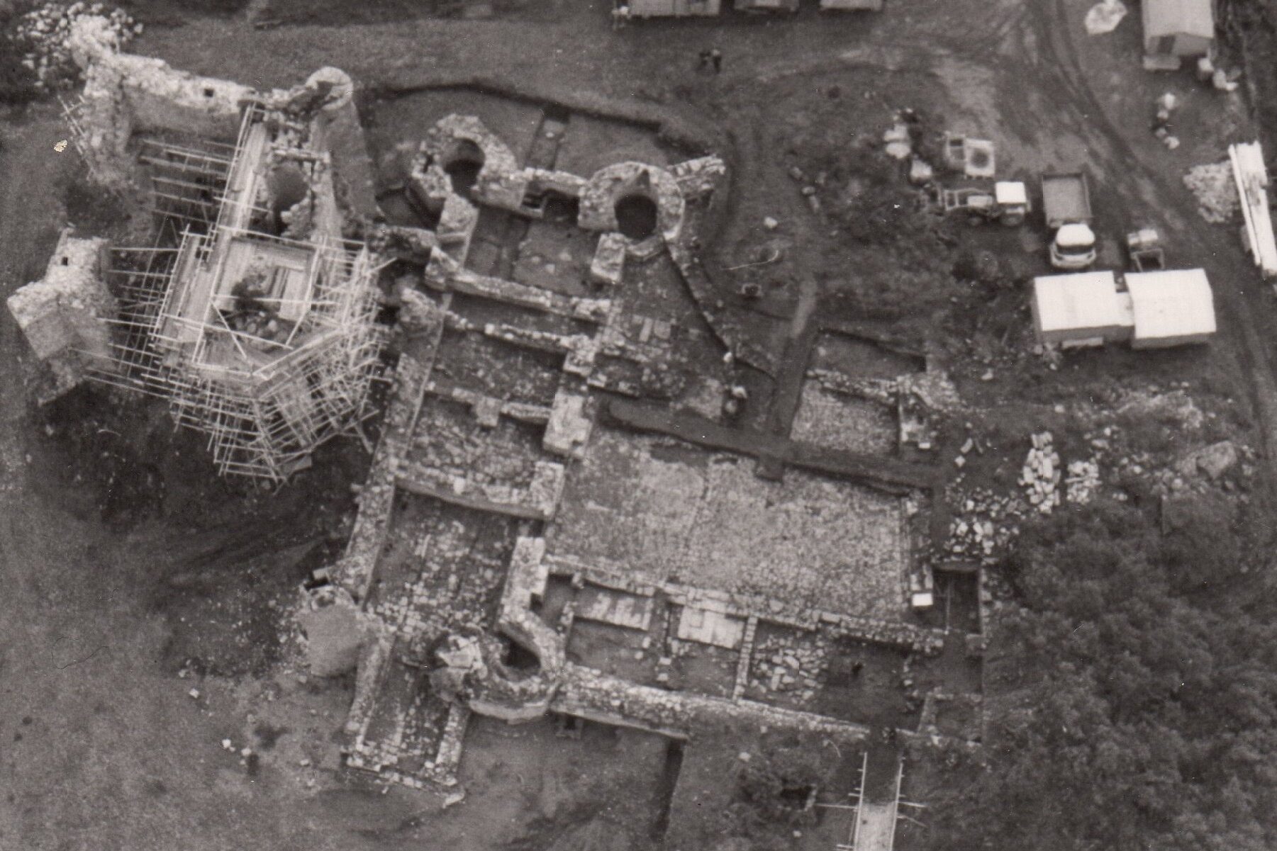
Between 1978-1982 Graham Fairclough led the excavation of Edlingham Castle, Northumberland. Rather than write up a traditional excavation report in his new book he takes a different and fascinating approach to understanding more about this castle.
Edlingham Castle, in Northumberland between Rothbury and Alnwick, comprises the remains of a medieval fortified house excavated for the predecessor of English Heritage between 1978 and 1982, and freely open to the public from the mid-1980s. The earliest known building is a hall-house (to use a slightly contested term) of c.1295-1300, probably originally inside a palisaded moated enclosure, but to this was added a chamber tower in the 1330s or ‘40s and a stone gatehouse. Its enclosing walls were rebuilt on several occasions until by the sixteenth century the place resembled a small courtyard house, which was finally abandoned by the 1650s. Edlingham thus shows in microcosm the impact of Anglo-Scottish border warfare in the fourteenth and fifteenth centuries, and of endemic lawlessness in the sixteenth, centuries. Another narrative, however, from a sociological perspective, first places the site and its owners in a national or even European context, and only in its later centuries into a more local, county-scale, world. A third Edlingham story would take most account of its architecture, notably the distinctive hall-house which before excavation was only guessed-at, and its imposing later tower that has usually been seen as part of the border ‘pele tower’ narrative – but both demand wider notice.
Air photo (with help from RAF Boulmer and one of their air-sea rescue helicopters) showing Edlingham Castle during excavation in 1979, from left, tower, hall-house, courtyard and walls of vaious dates (half-unexcavated) and gatehouse (unexcavated)
The excavations of 1978-82 focussed on the buried material remains of the site, which were described archaeologically and architecturally in summary interim articles prepared during the excavation and shortly afterwards. In my recent book, I took a different approach, and used biography – predominantly that of the castle’s first builder William de Felton, but also at some periods his peers, neighbours and family, as far as they are known – to inquire into Edlingham’s context and origins, and what might have influenced William in building the hall-house at Edlingham.
Born and probably raised in Shropshire, in some uncertain way an offshoot of the large Lestrange clan of Shropshire and Norfolk, William de Felton’s first small landholding was in Northamptonshire; he acquired land in Northumberland in the late 1270s on marriage to a Northumbrian heiress, Constance de Pontop, and he acquired Edlingham only in 1295. By then he had been a member of the royal household since c. 1278, as a personal usher (husser) in Edward I’s private chamber. He travelled the length and breadth of England and Wales with the king, spending three years in France, mainly in Gascony and Béarn. His duties included supervising the king’s personal building works, but he was also a soldier, and had fought in Wales, Flanders and Scotland. He was constable of a succession of royal castles in Wales, Scotland and England, notably, in company with the famous James of St George, Beaumaris and Linlithgow while they were under construction. Given his travels and experience, therefore, it is not surprising that whatever William was to build at Edlingham was not necessarily going to have a regional or local inspiration.
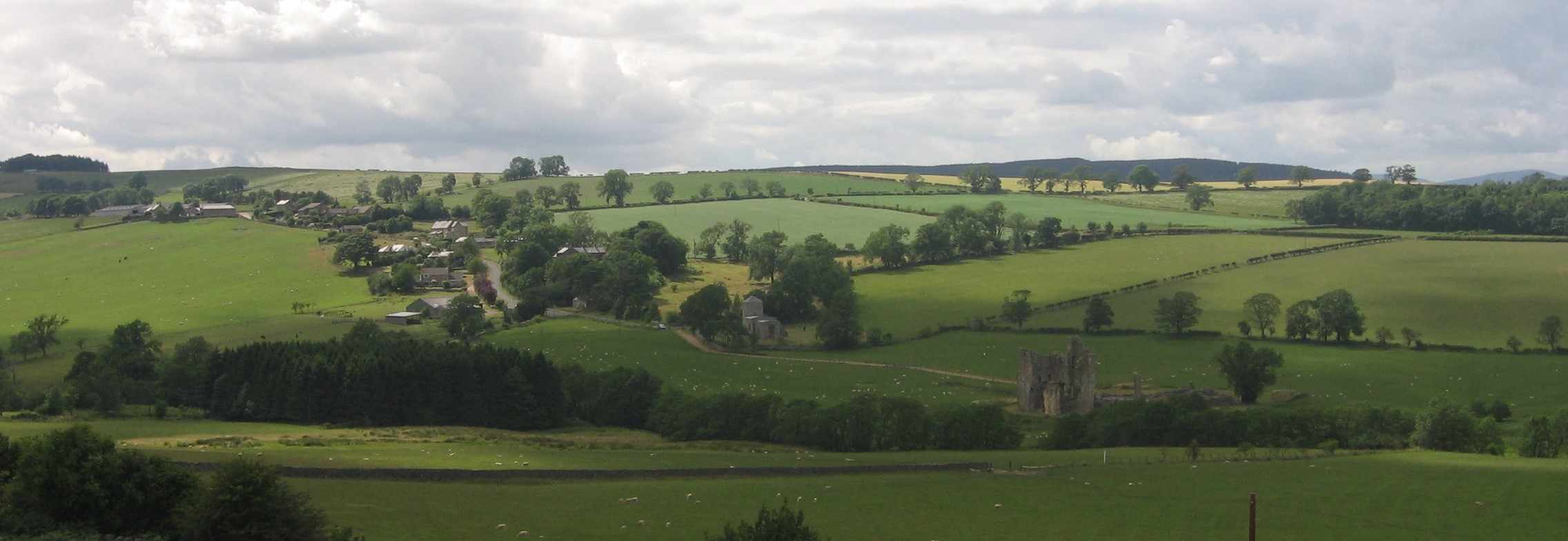
The valley of the Edlingham Burn: village, church and the castle showing its valley bottom location, copyright Graham Fairclough
The biographical approach taken in ‘A Medieval Life’ illuminates Edlingham’s origins in several ways. It is a current maxim in castle studies that castles and other elite houses should be considered in the context of their territories or landscapes, but this involves more than land and its affordances but more widely the social affinities, perceptions and abilities of their builders and inhabitants. Knowing a little of the events and travels of William’s life thus becomes significant in how we see Edlingham. My book therefore reflects on the accuracy or desirability of seeing Edlingham as a ‘Northern’ castle, coloured by a perception of Northumberland as a violent, vulnerable and distant (indeed different) border region. For William (and probably for his son and at least his first grandson), the house at Edlingham belonged to a much wider psychological and emotional landscape. Understanding the origins and early decades of the castle’s life reveals the mentality of a social and geographical network far beyond Northumberland.
Finally, let us not forget modern biography. The excavation and my early work on it occurred when I was an Inspector of Ancient Monuments, my work focussed on the material remains of the past. Since, roughly speaking, the middle 1990s, however, my work turned increasingly towards landscape ways of seeing the past. ‘A Medieval Life’, therefore, as well as being a biography, and an archaeology and history book, is also at least in intention a landscape book.
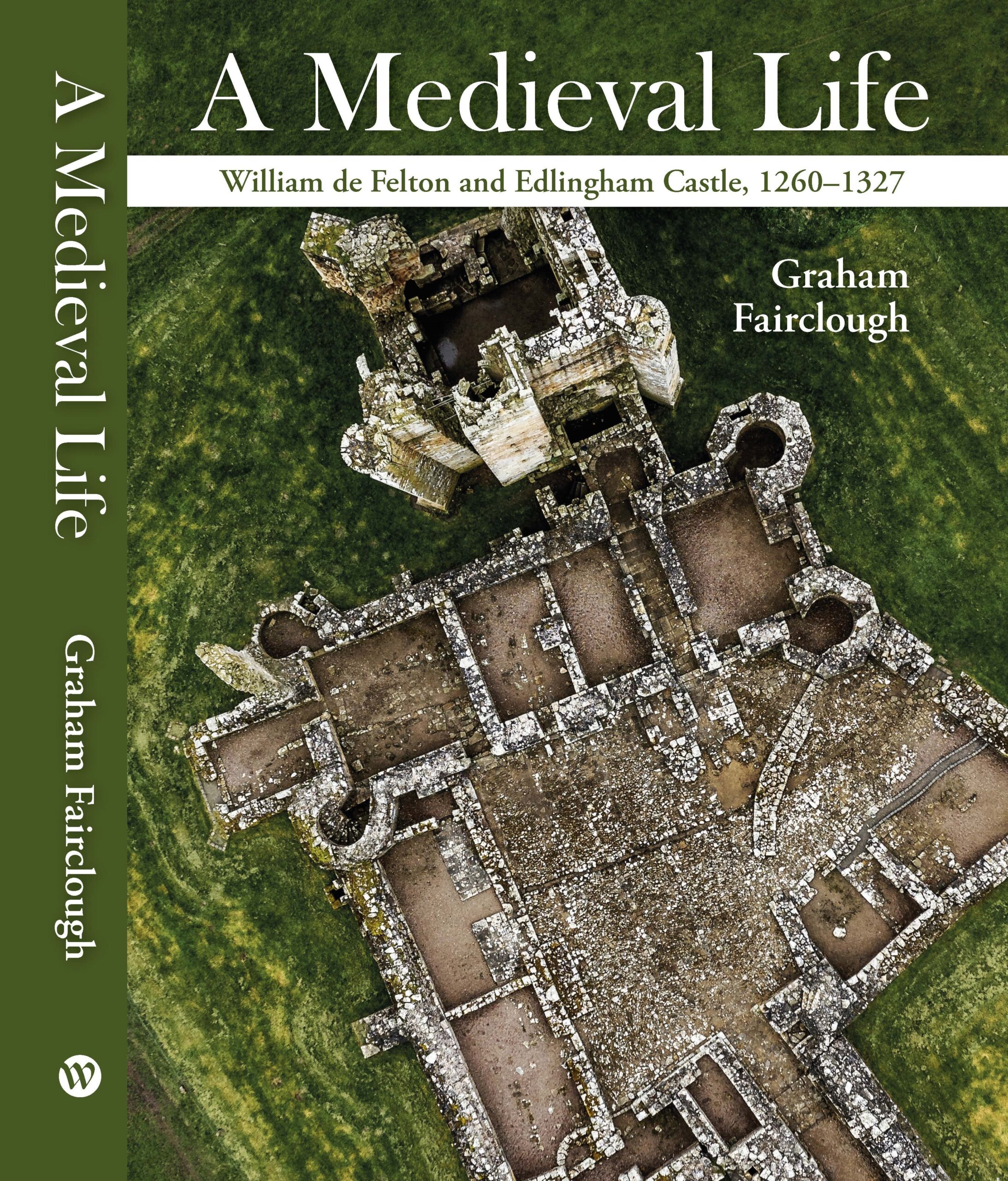
A Medieval Life: William de Felton and Edlingham Castle, 1260-1327 was published by Windgather Press (Oxbow books) in March 2025. A paper for Archaeologia Aeliana is also in preparation, and on 30 September 2026, Graham Fairclough is scheduled to give a talk about Edlingham and the book to the Society of Antiquaries of Newcastle upon Tyne.
Graham Fairclough, latterly of Newcastle University and before that Historic England and its predecessors, https://www.ncl.ac.uk/hca/people/profile/grahamfairclough.html, led five years of excavation at Edlingham Castle in Northumberland between 1978 and 1982. Early full publication of excavation results is a goal much-desired, but there is an argument for longer periods of reflection, and the recent book ‘A Medieval Life’ is a more matured discussion of the castle and the excavation framed primarily as a biography of its first builder, William de Felton.
From 20 April to 29 April, a community excavation took place at Knepp Castle involving local history and archaeology groups. Richard Nevell looks back on the dig.
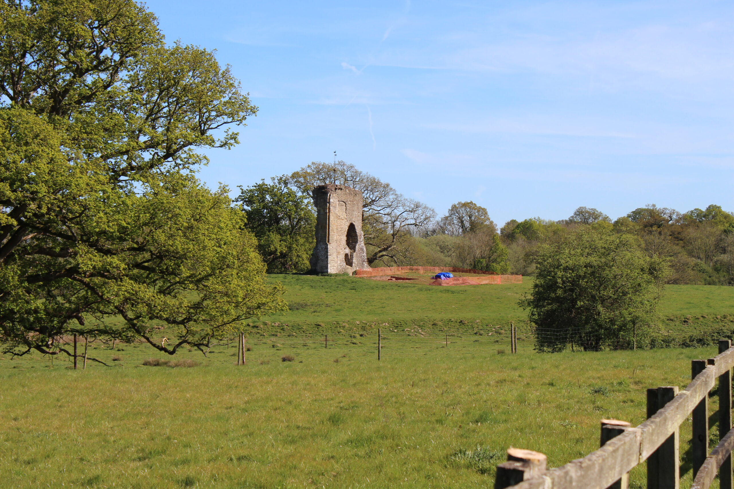
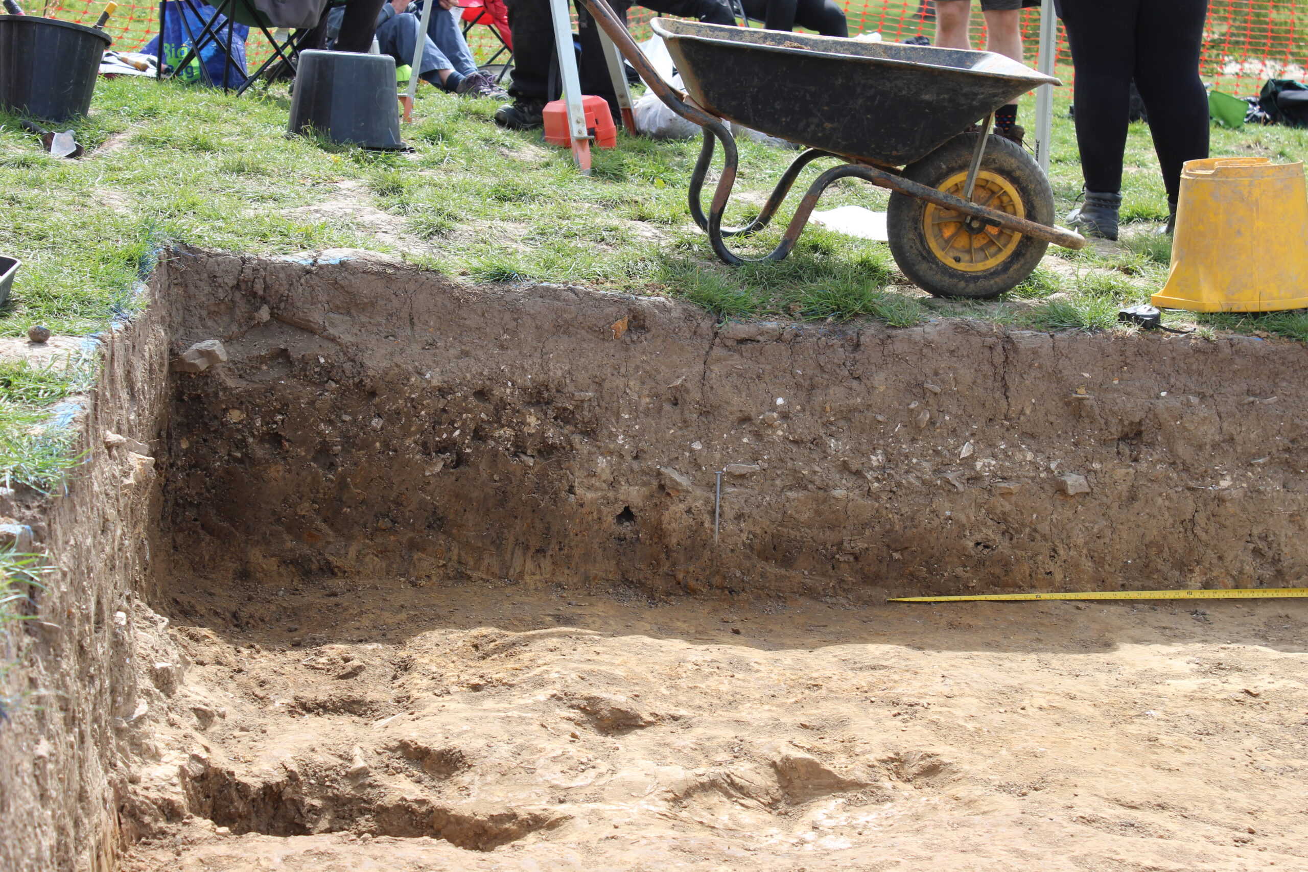
I woke up early on Monday 20 April to travel to Knepp Castle, navigating my way before rush hour began. I arrived on site just past 9am and suddenly it was happening. This was the first day of excavations at Knepp Castle, and with a weather forecast suggesting we would get the full use of the planned ten days of digging. More than 50 people volunteered to participate in the dig, joining from Shipley History Society, Horsham District Archaeology Group, and Worthing Archaeological Society as well as volunteers from the Knepp Estate – all under the expert supervision of Chris Butler Archaeological Services (CBAS).
The dig from afar. Photo by Richard Nevell, CC-BY-SA 4.0.
The focus of the ten-day stint was a 5m by 4m trench immediately west of the lone standing wall at the castle. There are a lot of assumptions about Knepp Castle and this was an opportunity to put them to the test, and to investigate an anomaly from the 2022 geophysical survey. The alignment was suggestive, but until we got down to the level of the anomaly what it represented was speculative.
In a broad sweep, Knepp Castle was first explicitly documented in 1210 but is likely older. It hosted several kings of England; featured in King John’s war with the barons; and was dismantled in the post-medieval period. The ruined wall stands tall in the landscape on its mound.
The first step was to remove the top soil. In an incredible feat for English weather, we not only had ten dry and (mostly) sunny days to dig but the weather in the lead-in to the dig has been mostly dry. Most of the time, rain slows things down but a sprinkling on the first day to soften the ground might have helped. That first day was the most physical, with volunteers wielding mattocks to remove the baked dry top layer of the ground. Already, artefacts started emerging – distinctly modern with some glass that might have come from beer bottles and a substantial metal piece of farming equipment which made a very effective paperweight when the weather got blustery.
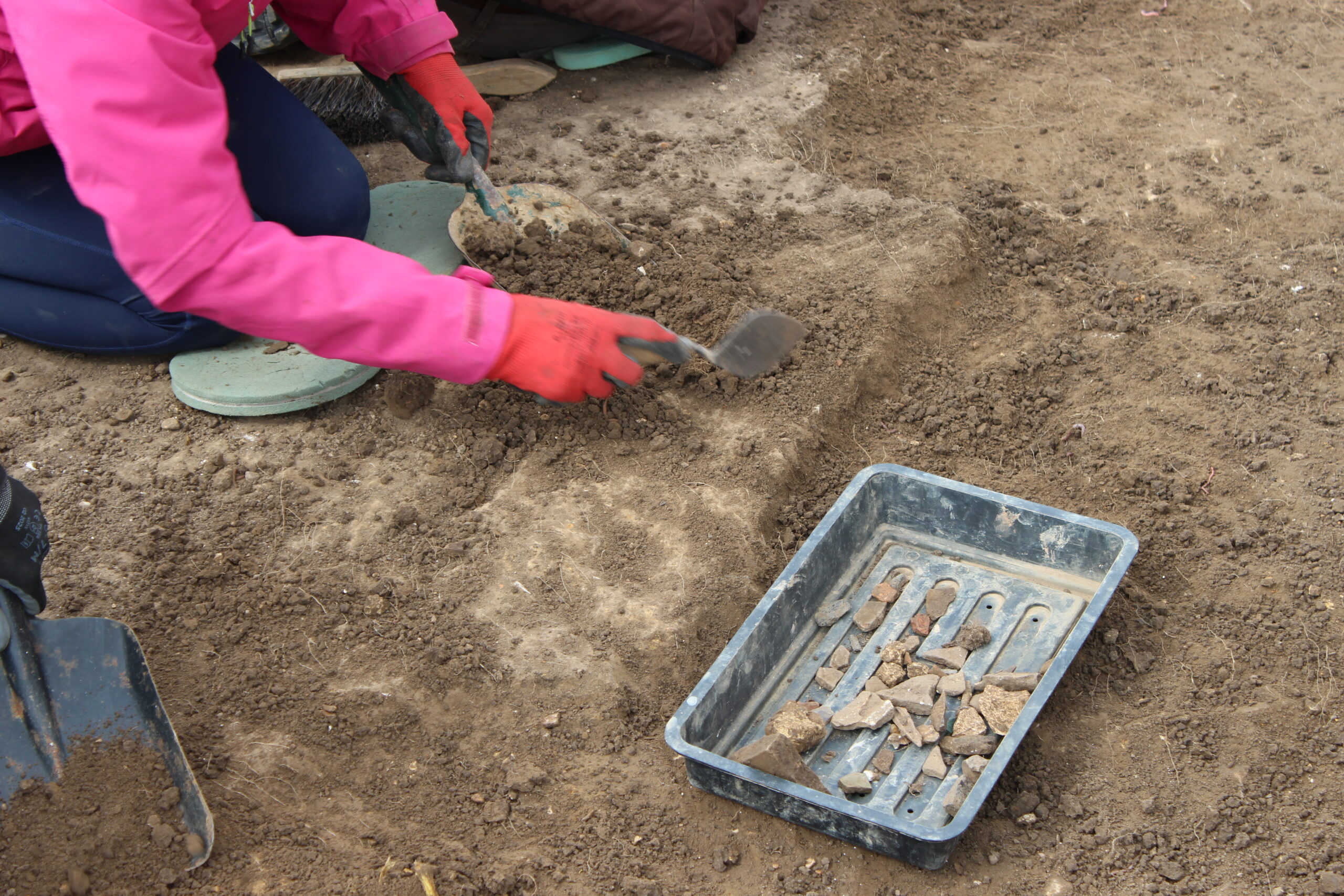
Troweling began on day 2. Photo by Richard Nevell, CC-BY-SA 4.0.
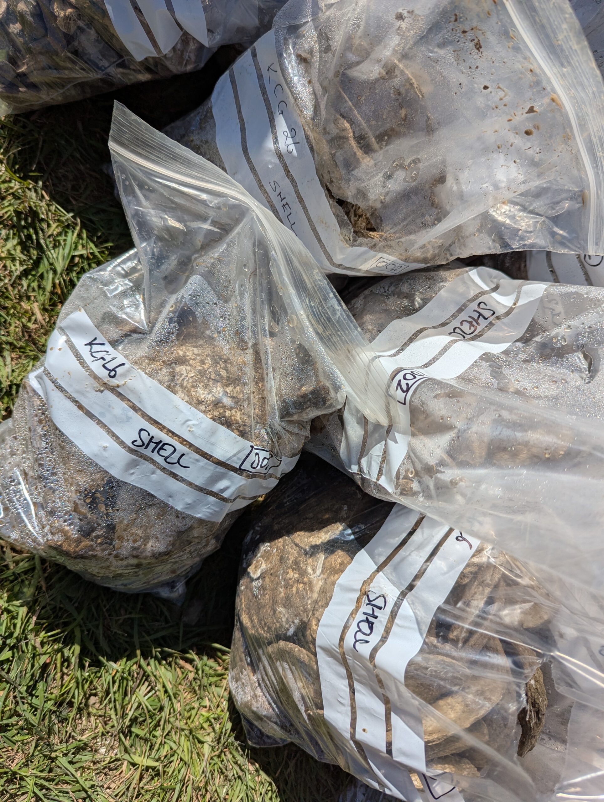
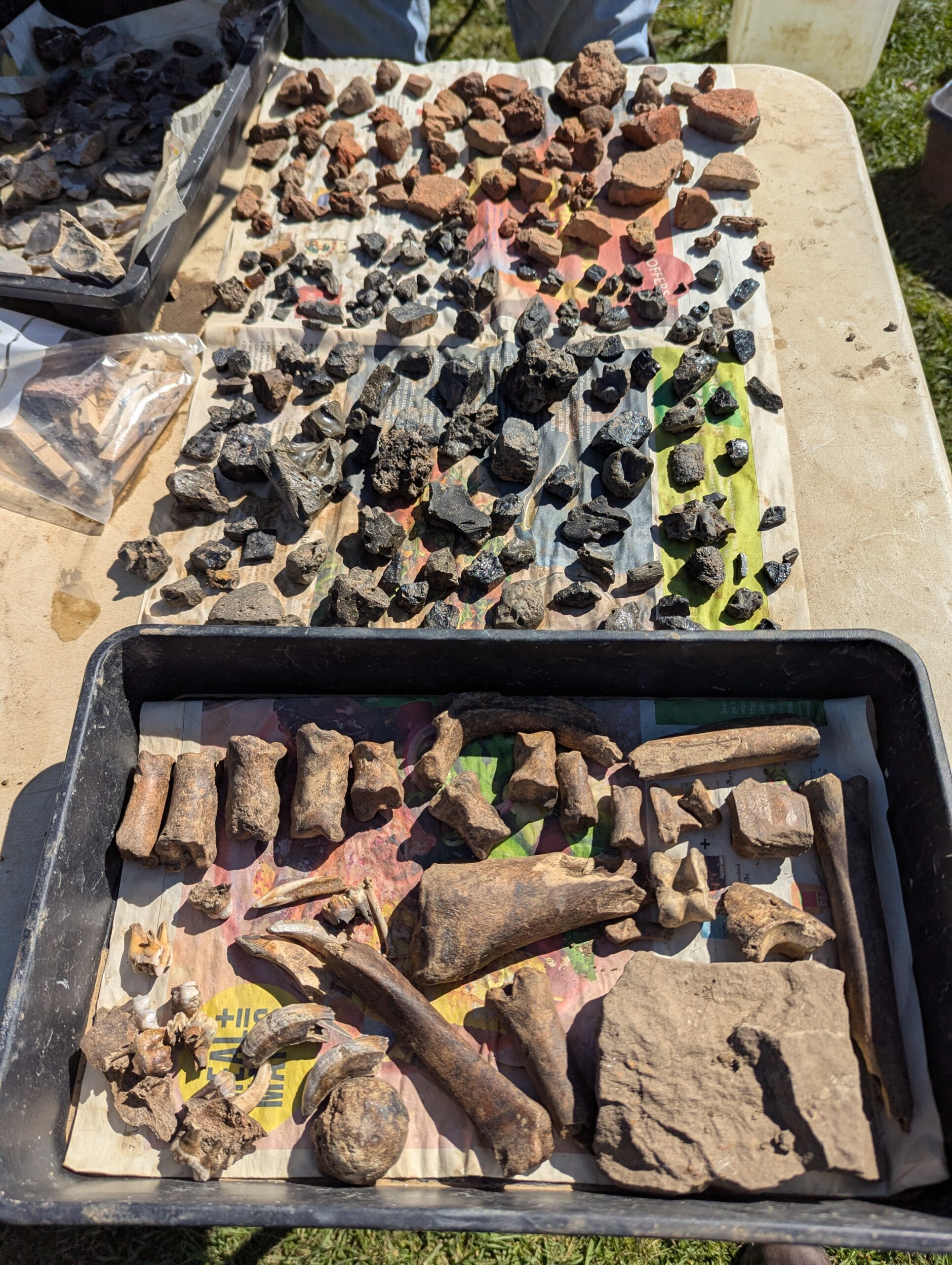
As we worked our way through the subsoil, along with more animal bones and pottery we started to encounter a lot of oyster shells, mortar, and pieces of sandstone. The interpretation of these finds is pending, but oysters would have been a readily accessible food source.
Bags of oysters shells, this was’t even the whole lot. Photo by Richard Nevell, CC-BY-SA 4.0.
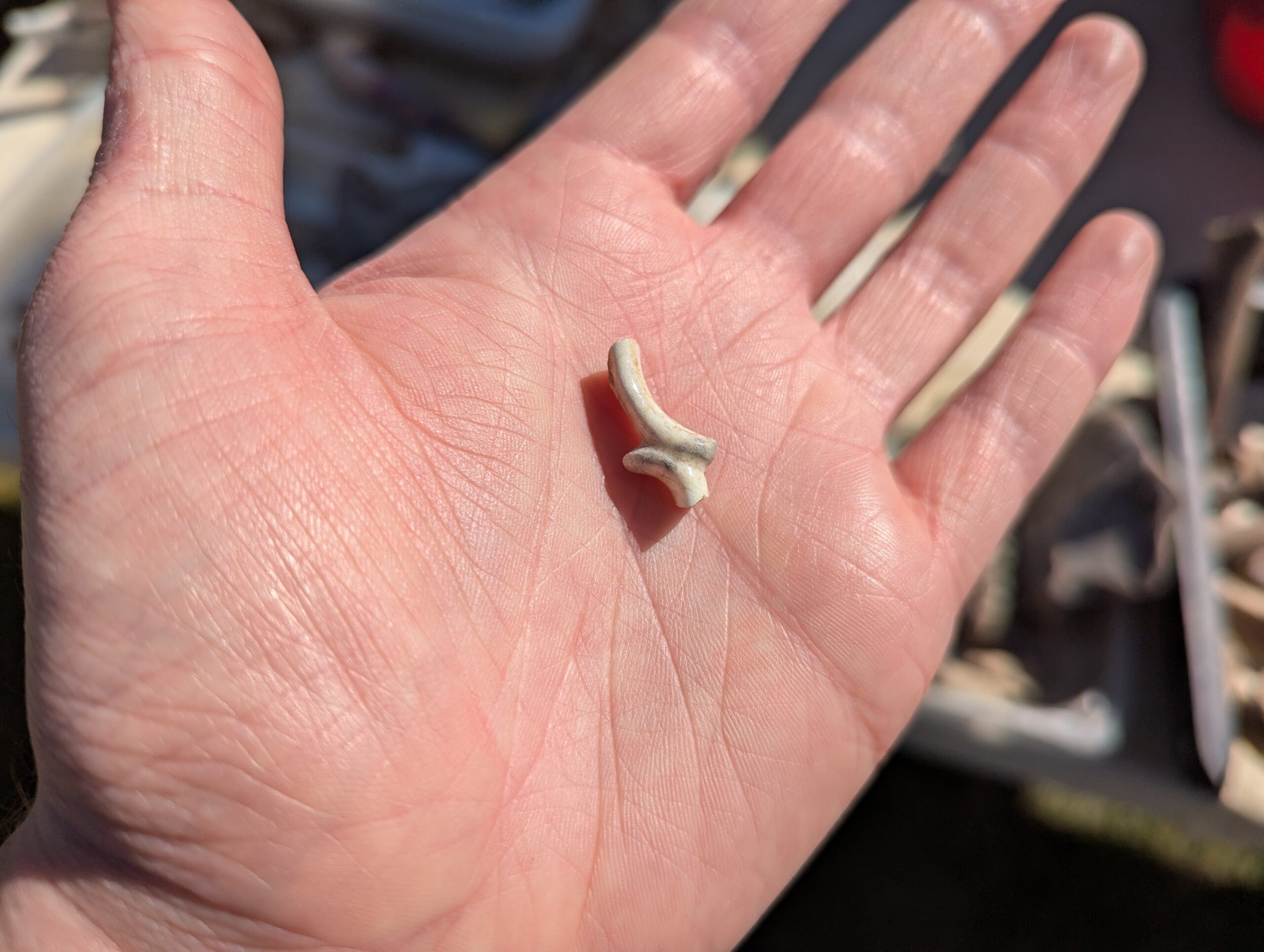
It is possible that the mortar and sandstone are left over from when the castle was dismantled, possibly in the 18th century. While I’m most interested in the castle’s medieval history, one of my favourite finds was a small fragment of teacup handle. That small piece of ceramic hints at people coming to the castle for a day out, and when the sun shone it was easy to see why. And though I’m no pottery expert, it was instantly recognisable.
A fragment of teacup handle. Photo by Richard Nevell, CC-BY-SA 4.0.
Over the course of the next week and a half, volunteers progressed deeper, uncovering more evidence of human activity at Knepp. The medieval pottery coming through and butchered animal bones were evidence of high-status feasting. Nails and stone may have been remnants of buildings at the castle that no longer stand.
The south side of the trench, with a stoney layer visible below the wheelbarrow. Photo by Richard Nevell, CC-BY-SA 4.0..
An area of burning mixed with slag suggests that some metal objects were created on-site. What we found was the waste from the process rather than the production site itself, but it would likely have been nearby. A volunteer asked me if this had been picked up by the geophysical survey. The magnetometry survey used in 2021 is typically good at picking up metalwork and evidence of burning, but we were digging in an area where there was too much interference from the lightning rod attached to the standing ruin to be able to pick out any detail from that survey.
A selection of animal bone, slag from metalworking, and ceramic building material found during the dig. Photo by Richard Nevell, CC-BY-SA 4.0.
As digging progressed there were regular questions about what depth we expected to find the anomaly at, and how far there was to go. When we got to the right depth we were faced with a bit of a puzzle. There was a change in soil discernable, and it looked like the anomaly may have been redeposited ‘natural’ – natural is the level at which there is no more human activity.
So what is the anomaly? The hypothesis that it might have been the wall of a building seems much less likely now. That is part of the process of putting theories to the test. At the same time, the process of excavating the castle has provided a lot of information about how it was used. Beyond the medieval period there were some prehistoric finds, pushing the history of human activity on the mound further back than anticipated. There was even a flint arrowhead, which I’ve been told is likely to date from the Early Bronze Age. The mound was a prominent feature in the landscape, and as such seems to have been a natural gathering point for people for millennia.
With the trench backfilled, the finds have been sent to the CBAS office for processing. Specialists are involved in evaluating the materials and refining preliminary interpretations. Once complete, the report will be available on the Castle Studies Trust website. In the meantime, if you’d like to relive the dig as it happened, I recorded some video updates from Knepp.
Dr Andrew Ferrara of Durham University, and project co-lead for investigating the Romanesque entrance looks at what they are doing and also hoping to learn from this detailed study of this spectacular doorway.
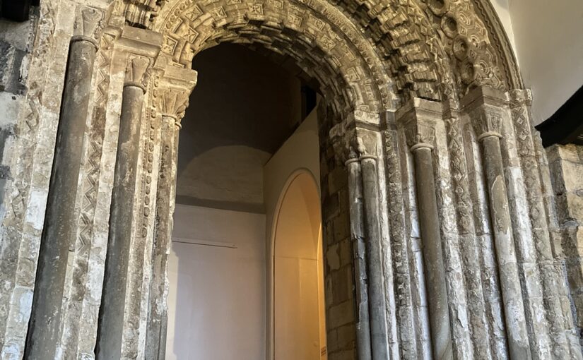
Durham Castle is one of the most prominent and renowned twelfth-century episcopal castles in Britain, sitting in the wider Durham UNESCO World Heritage site along with the cathedral. Construction is recorded as beginning in 1072, and the site has been in continuous occupation ever since. It operated as one of the bishop’s principal residences, right up until the nineteenth century when it was given to Durham University. As such, the complex has undergone multiple changes and alterations through the centuries, including significant interior and exterior works in the seventeenth and eighteenth centuries, with many of the medieval structures enclosed or adjusted by later development. Amongst the most significant building phases was the work undertaken during the episcopate of Bishop Hugh de Le Puiset (1153-95) and one of the most dynamic features from that period is the grand archway entrance inserted into the south façade of the castle’s North Range. Despite its longevity and pedigree, the castle has received surprisingly limited investigation or scholarly attention over the past century.
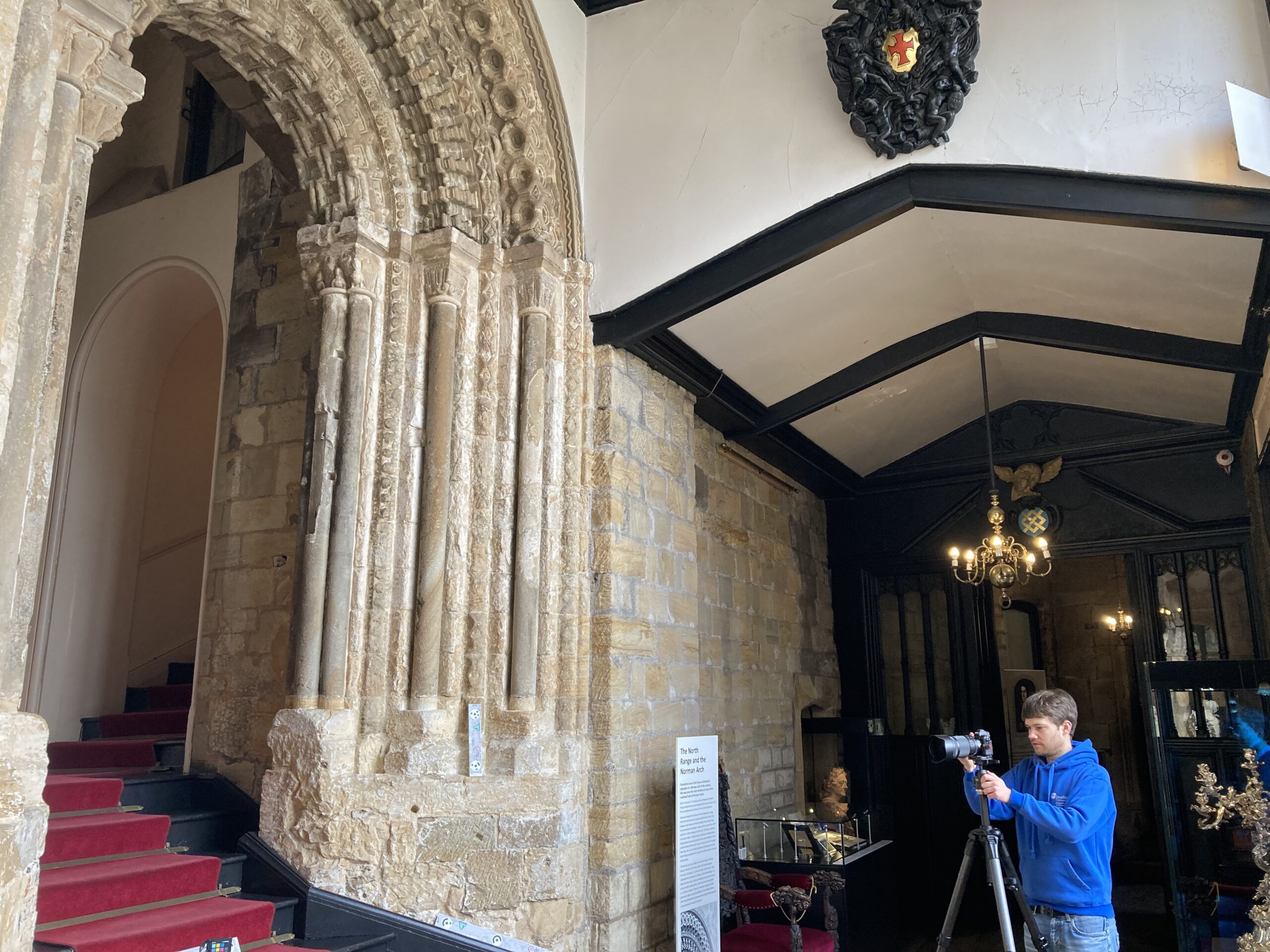
The current project, made possible through generous funding by the Castle Studies Trust, and led by Dr Andrew Ferrara and Professor Giles Gasper, is undertaking non-destructive photogrammetry of the Le Puiset archway. This methodology will result in a highly-detailed 3D model of the structure, ideal for detailed remote study. The same 3D data can then be used to generate orthographic projections, functioning as highly accurate blueprints of the arch. In addition, targeted high-resolution photography of details and additional 3D laser scans of the capitals will be undertaken. These combined methods will result in the most detailed and state-of-the-art records of this part of the castle for wider research and dissemination.
Durham Castle: Door scanning in action, copyright Dr Andrew Ferrara
This research focus has emerged from a renewed interest in the castle complex, catalysed by recent conservation and refurbishment works around the site which have revealed previously unknown architectural features. While the archway is exceptionally elaborate, it has never been subject to in-depth examination and set within the wider context of both Romanesque sculpture and the understanding of Durham Castle. The detailed modelling will allow for a thorough inspection of the features to be undertaken, in particular of diagnostic sculpture elements, enabling thorough comparison with other contemporary architectural outputs across the region and country. It is hoped that this will help tighten the chronology of the archway and set it in the context of other building projects undertaken by Bishop Le Puiset and other elite patrons. This will then further help inform understanding of the movement and concurrent projects of different master masons, and the sharing of architectural templates between secular and ecclesiastical sites and patrons in that milieu.
The project will also examine how the archway would have operated with the wider complex, to enable or restrict access and movement between the courtyard and internal spaces. This is crucial for better understanding the layout of the castle site in the late twelfth century, and how it would have looked and operated as the bishop’s See seat and one of the core centres of his palatine administration. The project will also explore the Durham archway within the context of ceremonial and embellished entranceways at contemporary castle structures like Newcastle, helping to understand where Le Puiset’s sponsored work sits within the wider corpus of elite buildings across the region.
All of this should result in a better comprehension of the layout and operation of the Durham castle in the late-twelfth century, and also of how this archway feature compares with other contemporary and preceding royal and local castle sites.
Ahead of the fieldwork beginning at Knepp Castle on 20 April, we hear from Dr Richard Nevell, the project lead about the project and what it aims to accomplish.
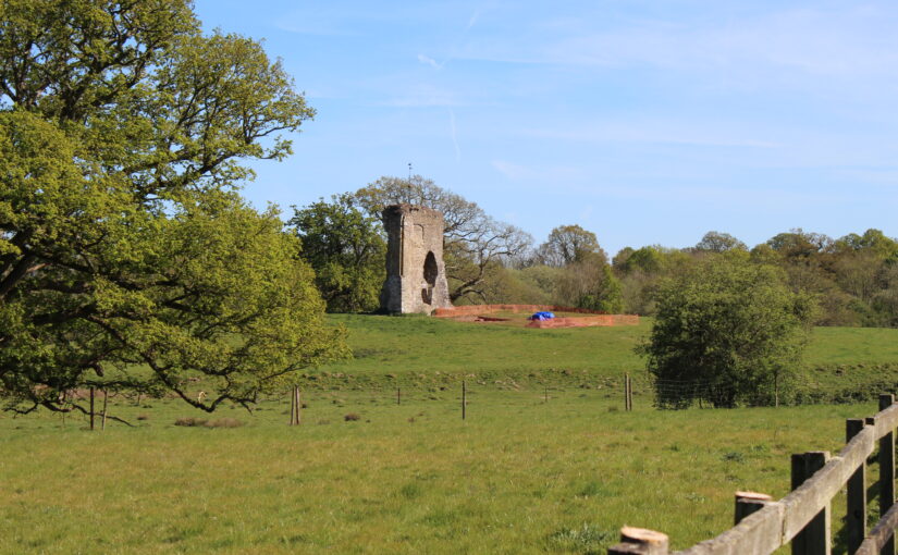
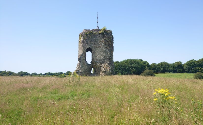
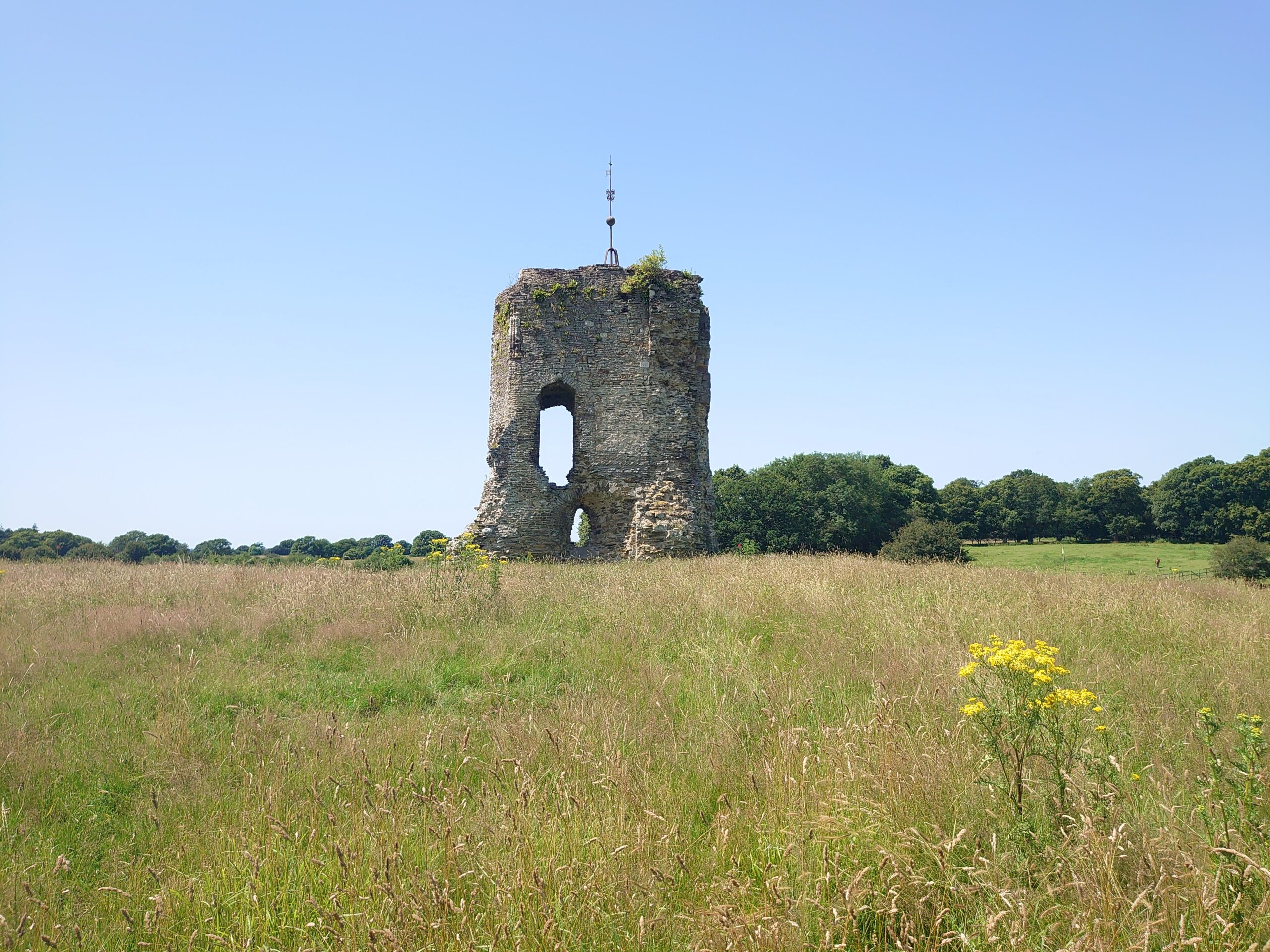
Ensconced in the countryside of West Sussex, Knepp is perhaps best known as a rewilding project – the first of its kind in England. At the eastern edge of the Knepp estate are the enigmatic remains of a tower. The 11m high wall stands on top of a mound just north of the River Adur, and immediately west of the A24 road. This is what remains above ground of Knepp Castle, and the Castle Studies Trust have awarded a grant to partially excavate the site and better understand what lies beneath the surface.
It is uncertain when Knepp Castle was established. It was likely founded by the powerful Braose family who held the land. The earliest mention of the castle dates to 1210 by which point it was under royal control as King John had confiscated the Braose family’s lands and property. John happily used Knepp as a hunting lodge, visiting to make use of the local deer park. The turmoil of his reign reached Knepp and on two occasions John ordered the destruction of Kneppp to prevent it from falling into enemy hands. Despite this the castle persisted and hosted royal visits from Henry III, Edward II, and Richard II. By the 1720s, most of the medieval castle had been dismantled leaving the lone wall that remains which was likely part of a keep (also known as a great tower).
The keep seen from the east
On 20 April Chris Butler Archaeological Services will begin a community excavation at Knepp Castle, and finish on 29 April. The work involves opening a trench just west of the standing wall, cutting across a feature identified in previous geophysical surveys. The castle is a scheduled monument and legally protected from unauthorised change, so any excavation has to be carefully planned to enhance the understanding of the site while preserving the remains.
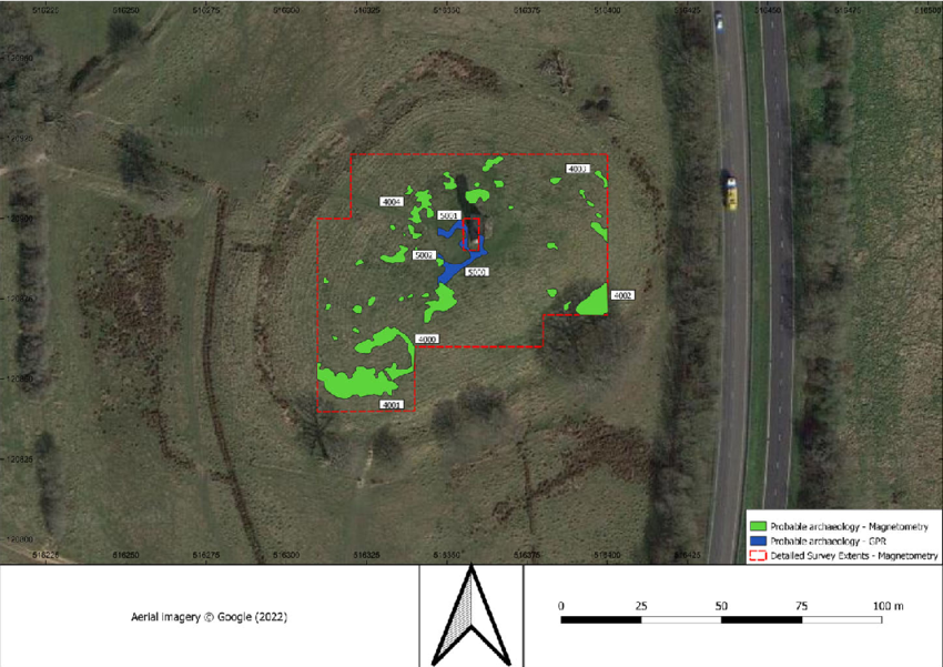
The geophysical surveys carried out in 2021 and 2022 showed that there are considerable remains buried at Knepp particularly west and south-west of the standing wall. Part of the challenge with this excavation has been deciding which of these features to investigate. Should we work on what could be a curtain wall marking the edge of the castle, a rectangular shape to the south that could be the trace of a gatehouse, or some of the anomalies on the south slope? In the end we decided to examine a sharp edged feature west of the keep. It looks like it could be a building, but it is on a different alignment to the keep and partly overlaps it. That means it may be an earlier phase of the castle.
The results of the 2021 and 2022 geophysical surveys. Green indicates features identified through a magnetometer survey, and blue those found with ground-penetrating radar. The standing wall is roughly in the middle, and outlined by a red dashed box.
The remains are not immediately obviously castle-like. During the geophysical surveys passing members of the public asked what the site was. The motte is not as pronounced as at other castles, and the wall looks old without necessarily looking like a castle. By excavating at Knepp we hope to better understand how the site developed. The documentary sources give some hints of events, but little information on what was built when. Personally, I hope that we might find some evidence of the destruction of 1216 following King John’s orders, but that’s unlikely.
Though the geophysical evidence is strong, we can’t be certain about the archaeology until we start digging. What has been especially encouraging is how enthusiastic local communities have been to learn about Knepp’s medieval history and get involved with the fieldwork.
Here’s hoping to some exciting finds from Knepp Castle later this month!